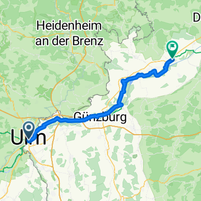
Ulm-Helfenstein (Geislingen)
A cycling route starting in Ulm, Baden-Württemberg, Germany.
Overview
About this route
Kleine Tour von Ulm nach Geislingen (Helfenstein) - möglichst nur Radwege - durchs Lonetal:
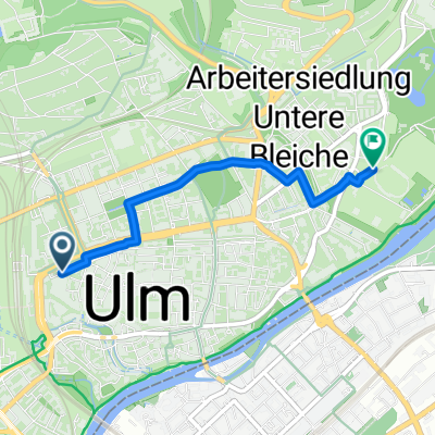
Route: Startpunkt Ulm, Blautalcenter:
Ulm, Jungingen, Eiselau, Vorderdenkental, Westerstetten, Lonsee, Urspring, Amstetten, Weiler ob Helfenstein, Geislingen, Amstetten
von Amstetten nach Ulm wie Hinfahrt!
Am Sa. und So. ist an der Helfenstein die Schenke offen. Kurz vor dem Anstieg (in Amstetten / Ziegelhütte) gibt es eine Bikerwirtschaft.
- -:--
- Duration
- 44.6 km
- Distance
- 425 m
- Ascent
- 327 m
- Descent
- ---
- Avg. speed
- ---
- Avg. speed
Route quality
Waytypes & surfaces along the route
Waytypes
Track
12.7 km
(28 %)
Quiet road
11.2 km
(25 %)
Surfaces
Paved
31.2 km
(70 %)
Unpaved
5.5 km
(12 %)
Asphalt
28.2 km
(63 %)
Gravel
3.8 km
(9 %)
Continue with Bikemap
Use, edit, or download this cycling route
You would like to ride Ulm-Helfenstein (Geislingen) or customize it for your own trip? Here is what you can do with this Bikemap route:
Free features
- Save this route as favorite or in collections
- Copy & plan your own version of this route
- Sync your route with Garmin or Wahoo
Premium features
Free trial for 3 days, or one-time payment. More about Bikemap Premium.
- Navigate this route on iOS & Android
- Export a GPX / KML file of this route
- Create your custom printout (try it for free)
- Download this route for offline navigation
Discover more Premium features.
Get Bikemap PremiumFrom our community
Other popular routes starting in Ulm
- Ulm - Firedrichshafen (Bodensee)
- Distance
- 131.3 km
- Ascent
- 929 m
- Descent
- 969 m
- Location
- Ulm, Baden-Württemberg, Germany
- Donauradweg Ulm nach Passa_TheBest
- Distance
- 386.8 km
- Ascent
- 175 m
- Descent
- 351 m
- Location
- Ulm, Baden-Württemberg, Germany
- Ulm - Blaubeuren - Ehingen - Erbach - Ulm
- Distance
- 68.1 km
- Ascent
- 266 m
- Descent
- 266 m
- Location
- Ulm, Baden-Württemberg, Germany
- Ulm-Seissen-Ulm
- Distance
- 62.6 km
- Ascent
- 882 m
- Descent
- 859 m
- Location
- Ulm, Baden-Württemberg, Germany
- Ulm_Kempten_Lindau
- Distance
- 190.1 km
- Ascent
- 1,603 m
- Descent
- 1,682 m
- Location
- Ulm, Baden-Württemberg, Germany
- Ulm-Donau-Bodensee-Iller
- Distance
- 405.6 km
- Ascent
- 754 m
- Descent
- 753 m
- Location
- Ulm, Baden-Württemberg, Germany
- Hills @Blautal
- Distance
- 48.9 km
- Ascent
- 540 m
- Descent
- 540 m
- Location
- Ulm, Baden-Württemberg, Germany
- Kleine Runde von Ulm ins Oberschwäbische
- Distance
- 86.2 km
- Ascent
- 524 m
- Descent
- 513 m
- Location
- Ulm, Baden-Württemberg, Germany
Open it in the app