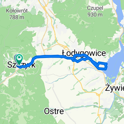
Skrzyczne pętla
A cycling route starting in Szczyrk, Silesian Voivodeship, Poland.
Overview
About this route
- 5 h 39 min
- Duration
- 25.3 km
- Distance
- 1,067 m
- Ascent
- 1,067 m
- Descent
- 4.5 km/h
- Avg. speed
- 1,252 m
- Avg. speed
Route photos
Route quality
Waytypes & surfaces along the route
Waytypes
Track
16.6 km
(66 %)
Path
3.2 km
(13 %)
Surfaces
Paved
1.7 km
(7 %)
Unpaved
14.9 km
(59 %)
Gravel
8.2 km
(32 %)
Unpaved (undefined)
6.1 km
(24 %)
Continue with Bikemap
Use, edit, or download this cycling route
You would like to ride Skrzyczne pętla or customize it for your own trip? Here is what you can do with this Bikemap route:
Free features
- Save this route as favorite or in collections
- Copy & plan your own version of this route
- Sync your route with Garmin or Wahoo
Premium features
Free trial for 3 days, or one-time payment. More about Bikemap Premium.
- Navigate this route on iOS & Android
- Export a GPX / KML file of this route
- Create your custom printout (try it for free)
- Download this route for offline navigation
Discover more Premium features.
Get Bikemap PremiumFrom our community
Other popular routes starting in Szczyrk
- Skrzyczne-Barania Góra
- Distance
- 44.5 km
- Ascent
- 1,005 m
- Descent
- 1,467 m
- Location
- Szczyrk, Silesian Voivodeship, Poland
- 2018 Żywiec dzień 2
- Distance
- 84.5 km
- Ascent
- 1,242 m
- Descent
- 1,243 m
- Location
- Szczyrk, Silesian Voivodeship, Poland
- dookoła skrzycznego
- Distance
- 71.8 km
- Ascent
- 995 m
- Descent
- 987 m
- Location
- Szczyrk, Silesian Voivodeship, Poland
- Kotarz,Salmopol, Skrzyczne
- Distance
- 26.2 km
- Ascent
- 983 m
- Descent
- 983 m
- Location
- Szczyrk, Silesian Voivodeship, Poland
- Szczyrk Klimczok Wisła Brenna
- Distance
- 53.3 km
- Ascent
- 1,629 m
- Descent
- 1,627 m
- Location
- Szczyrk, Silesian Voivodeship, Poland
- Skrzyczne - Barania G.
- Distance
- 46.8 km
- Ascent
- 842 m
- Descent
- 1,541 m
- Location
- Szczyrk, Silesian Voivodeship, Poland
- 2013-05-31 Szczyrk #4
- Distance
- 52 km
- Ascent
- 1,977 m
- Descent
- 1,971 m
- Location
- Szczyrk, Silesian Voivodeship, Poland
- Szczyrk-BaraniaG-Stożek-Czantoria-Ustroń-PrzełSalmopol-Szczyrk CLONED FROM ROUTE 449312
- Distance
- 93 km
- Ascent
- 2,463 m
- Descent
- 2,463 m
- Location
- Szczyrk, Silesian Voivodeship, Poland