

Garmisch-Riva del Garda 2022
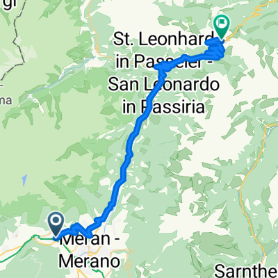
Teil_4_20220715_Algund-Kalterer_See-Trento
A cycling route starting in Algund, Trentino-Alto Adige, Italy.
Overview
About this route
Über die Weinberge bzw. Weinstraße immer weiter Richtung Süden. War zwar ganz schön hügelig, bei knapp 40 Grad ziemlich anstrengend, belohnt wurde man aber durch eine schöne Aussicht. Das letzte Stück hatten wir stürmischen Gegenwind.
- -:--
- Duration
- 98.5 km
- Distance
- 935 m
- Ascent
- 1,100 m
- Descent
- ---
- Avg. speed
- 412 m
- Max. altitude

Part of
6 stages
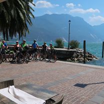
Route photos


Route quality
Waytypes & surfaces along the route
Waytypes
Cycleway
46.8 km
(47 %)
Quiet road
21.3 km
(22 %)
Surfaces
Paved
88.9 km
(90 %)
Unpaved
1.1 km
(1 %)
Asphalt
84.5 km
(86 %)
Paved (undefined)
4.3 km
(4 %)
Continue with Bikemap
Use, edit, or download this cycling route
You would like to ride Teil_4_20220715_Algund-Kalterer_See-Trento or customize it for your own trip? Here is what you can do with this Bikemap route:
Free features
- Save this route as favorite or in collections
- Copy & plan your own version of this route
- Split it into stages to create a multi-day tour
- Sync your route with Garmin or Wahoo
Premium features
Free trial for 3 days, or one-time payment. More about Bikemap Premium.
- Navigate this route on iOS & Android
- Export a GPX / KML file of this route
- Create your custom printout (try it for free)
- Download this route for offline navigation
Discover more Premium features.
Get Bikemap PremiumFrom our community
Other popular routes starting in Algund
 Algund -Aschbach
- Distance
- 14.4 km
- Ascent
- 1,146 m
- Descent
- 122 m
- Location
- Algund, Trentino-Alto Adige, Italy
 Allgund - Jaufenpass
- Distance
- 43 km
- Ascent
- 1,842 m
- Descent
- 146 m
- Location
- Algund, Trentino-Alto Adige, Italy
 Hotel Vigiljoch
- Distance
- 37 km
- Ascent
- 1,523 m
- Descent
- 1,510 m
- Location
- Algund, Trentino-Alto Adige, Italy
 RR_2013_Traininngslager_04
- Distance
- 94.7 km
- Ascent
- 2,756 m
- Descent
- 2,749 m
- Location
- Algund, Trentino-Alto Adige, Italy
 Gasthof Brünnl
- Distance
- 9.5 km
- Ascent
- 434 m
- Descent
- 2 m
- Location
- Algund, Trentino-Alto Adige, Italy
 Algund Falzeben 2
- Distance
- 19.7 km
- Ascent
- 1,355 m
- Descent
- 27 m
- Location
- Algund, Trentino-Alto Adige, Italy
 Mitterplars, Algund nach Lingweg 24, Dorf Tirol
- Distance
- 11.8 km
- Ascent
- 317 m
- Descent
- 197 m
- Location
- Algund, Trentino-Alto Adige, Italy
 Bergtour über Gampenjoch und Meldelpass
- Distance
- 102.7 km
- Ascent
- 1,751 m
- Descent
- 1,751 m
- Location
- Algund, Trentino-Alto Adige, Italy
Open it in the app