

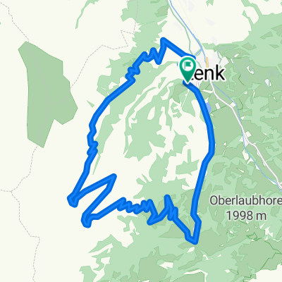
Lenk Walleggstube-Zweisimmen
A cycling route starting in Lenk, Canton of Bern, Switzerland.
Overview
About this route
- 1 h 27 min
- Duration
- 15.5 km
- Distance
- 135 m
- Ascent
- 533 m
- Descent
- 10.6 km/h
- Avg. speed
- 1,345 m
- Max. altitude
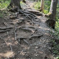
Route photos


Route quality
Waytypes & surfaces along the route
Waytypes
Quiet road
8.1 km
(52 %)
Track
5.1 km
(33 %)
Surfaces
Paved
7.6 km
(49 %)
Unpaved
4.8 km
(31 %)
Asphalt
7.6 km
(49 %)
Loose gravel
4.3 km
(28 %)
Continue with Bikemap
Use, edit, or download this cycling route
You would like to ride Lenk Walleggstube-Zweisimmen or customize it for your own trip? Here is what you can do with this Bikemap route:
Free features
- Save this route as favorite or in collections
- Copy & plan your own version of this route
- Sync your route with Garmin or Wahoo
Premium features
Free trial for 3 days, or one-time payment. More about Bikemap Premium.
- Navigate this route on iOS & Android
- Export a GPX / KML file of this route
- Create your custom printout (try it for free)
- Download this route for offline navigation
Discover more Premium features.
Get Bikemap PremiumFrom our community
Other popular routes starting in Lenk
 Lenk iS BE - Luzern (Seebrücke)
- Distance
- 157.9 km
- Ascent
- 417 m
- Descent
- 1,042 m
- Location
- Lenk, Canton of Bern, Switzerland
 Othmar
- Distance
- 15.8 km
- Ascent
- 499 m
- Descent
- 499 m
- Location
- Lenk, Canton of Bern, Switzerland
 Lenk - Simmenfälle - Siebenbrunnen - Langermatte - Iffigenalp - Iffigenfall - Lenkersee - Lenk
- Distance
- 28.8 km
- Ascent
- 935 m
- Descent
- 934 m
- Location
- Lenk, Canton of Bern, Switzerland
 Lenk, Hahnenmoos, Bummerenpass,Sieben Brünnen, lenk
- Distance
- 24.6 km
- Ascent
- 932 m
- Descent
- 1,020 m
- Location
- Lenk, Canton of Bern, Switzerland
 AlpenX T2
- Distance
- 94.1 km
- Ascent
- 1,862 m
- Descent
- 1,960 m
- Location
- Lenk, Canton of Bern, Switzerland
 Lenk - Gutenbrunnen -
- Distance
- 24.6 km
- Ascent
- 711 m
- Descent
- 712 m
- Location
- Lenk, Canton of Bern, Switzerland
 Lenk Betelberg
- Distance
- 24 km
- Ascent
- 906 m
- Descent
- 909 m
- Location
- Lenk, Canton of Bern, Switzerland
 Grosse Summerwald Tour, Lenk im Simmental
- Distance
- 27 km
- Ascent
- 1,047 m
- Descent
- 1,046 m
- Location
- Lenk, Canton of Bern, Switzerland
Open it in the app