

Übers Maifeld zur Burg Eltz
A cycling route starting in Kehrig, Rhineland-Palatinate, Germany.
Overview
About this route
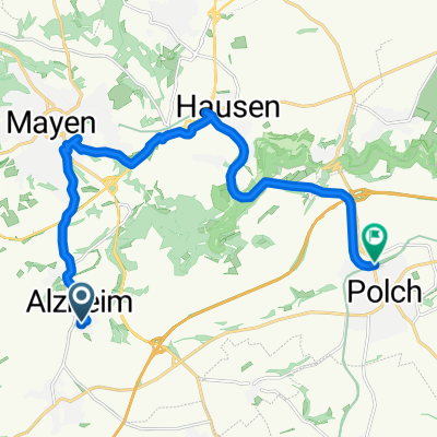
Route die von Alzheim aus über Gering, Kollig, Pillig, Wierschem zur Burg Eltz führt. Von da an dem Eltztal folgend bis zur Mosel und übers schöne Schrumpftal nach Münstermaifeld. Ab Münstermaifeld geht es über den Fahrradweg nach Polch und zurück nach Alzheim
- -:--
- Duration
- 52 km
- Distance
- 539 m
- Ascent
- 545 m
- Descent
- ---
- Avg. speed
- ---
- Max. altitude
Continue with Bikemap
Use, edit, or download this cycling route
You would like to ride Übers Maifeld zur Burg Eltz or customize it for your own trip? Here is what you can do with this Bikemap route:
Free features
- Save this route as favorite or in collections
- Copy & plan your own version of this route
- Sync your route with Garmin or Wahoo
Premium features
Free trial for 3 days, or one-time payment. More about Bikemap Premium.
- Navigate this route on iOS & Android
- Export a GPX / KML file of this route
- Create your custom printout (try it for free)
- Download this route for offline navigation
Discover more Premium features.
Get Bikemap PremiumFrom our community
Other popular routes starting in Kehrig
 Conder Straße 7, Mayen nach Carl-Benz-Straße 7, Polch
- Distance
- 7.9 km
- Ascent
- 100 m
- Descent
- 62 m
- Location
- Kehrig, Rhineland-Palatinate, Germany
 Mayener Wald + Elztal + Blumenrather Heide
- Distance
- 33.2 km
- Ascent
- 526 m
- Descent
- 528 m
- Location
- Kehrig, Rhineland-Palatinate, Germany
 Gartenstraße 13, Kehrig nach Brohltalstraße 36, Rieden
- Distance
- 17.4 km
- Ascent
- 361 m
- Descent
- 321 m
- Location
- Kehrig, Rhineland-Palatinate, Germany
 Spurzemer Weg 1, Mayen nach Trimbser Straße 3, Polch
- Distance
- 78 km
- Ascent
- 184 m
- Descent
- 262 m
- Location
- Kehrig, Rhineland-Palatinate, Germany
 Übers Maifeld zur Burg Eltz
- Distance
- 52 km
- Ascent
- 539 m
- Descent
- 545 m
- Location
- Kehrig, Rhineland-Palatinate, Germany
 Kehrig-Mayen
- Distance
- 6.2 km
- Ascent
- 56 m
- Descent
- 168 m
- Location
- Kehrig, Rhineland-Palatinate, Germany
 Eifel Tour
- Distance
- 81.1 km
- Ascent
- 871 m
- Descent
- 1,021 m
- Location
- Kehrig, Rhineland-Palatinate, Germany
 K25 24, Kehrig nach Hauptstraße 24, Winterspelt
- Distance
- 102.8 km
- Ascent
- 2,788 m
- Descent
- 2,639 m
- Location
- Kehrig, Rhineland-Palatinate, Germany
Open it in the app