

CYCLING THE RHINE: Route Approach B
A cycling route starting in Hoek van Holland, South Holland, The Netherlands.
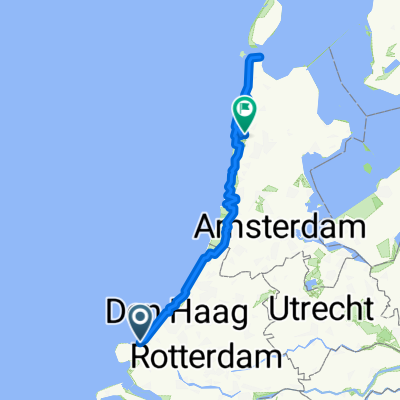
Overview
About this route
Europoort Ferry Terminal to
1. Hoek van Holland ferry terminal (via Maassluis ferry) 2. Scheveningen ferry terminal (The Hague / Den Haag) 3. Katwijk aan Zee (Old Rhine Sea Lock) This is an approach route to the start point of the Rhine Route, at Katwijk aan Zee, as described in the cycling guide book, CYCLING THE RHINE ROUTE by John Powell. NOTE: There is a ferry from Europoort to Hoek van Holland. This described route takes you via the Maassluis ferry, through the deer park, past wartime bunkers, along the right bank of the New Waterway.- -:--
- Duration
- 64.1 km
- Distance
- 58 m
- Ascent
- 59 m
- Descent
- ---
- Avg. speed
- ---
- Max. altitude
Route highlights
Points of interest along the route
Point of interest after 11.4 km
Route signs (LF1b and Maassluis ferry) may persuade you to turn right here. You can safely follow the signs; you'll be taken around the houses, but end up at the Maassluis ferry all the same.
Continue with Bikemap
Use, edit, or download this cycling route
You would like to ride CYCLING THE RHINE: Route Approach B or customize it for your own trip? Here is what you can do with this Bikemap route:
Free features
- Save this route as favorite or in collections
- Copy & plan your own version of this route
- Sync your route with Garmin or Wahoo
Premium features
Free trial for 3 days, or one-time payment. More about Bikemap Premium.
- Navigate this route on iOS & Android
- Export a GPX / KML file of this route
- Create your custom printout (try it for free)
- Download this route for offline navigation
Discover more Premium features.
Get Bikemap PremiumFrom our community
Other popular routes starting in Hoek van Holland
 Route to Delft
- Distance
- 21.8 km
- Ascent
- 11 m
- Descent
- 11 m
- Location
- Hoek van Holland, South Holland, The Netherlands
 Hook of Holland, Hoek van Holland to Hook of Holland, Hoek van Holland
- Distance
- 46.7 km
- Ascent
- 252 m
- Descent
- 342 m
- Location
- Hoek van Holland, South Holland, The Netherlands
 Van Hoek van Holland langs de Nieuwe Waterweg naar Maassluis
- Distance
- 29.2 km
- Ascent
- 15 m
- Descent
- 13 m
- Location
- Hoek van Holland, South Holland, The Netherlands
 Easter Cycling
- Distance
- 201.4 km
- Ascent
- 639 m
- Descent
- 627 m
- Location
- Hoek van Holland, South Holland, The Netherlands
 Hook to Amsterdam
- Distance
- 87.3 km
- Ascent
- 22 m
- Descent
- 21 m
- Location
- Hoek van Holland, South Holland, The Netherlands
 Hoek van Holland-Nieweschans
- Distance
- 553.3 km
- Ascent
- 55 m
- Descent
- 65 m
- Location
- Hoek van Holland, South Holland, The Netherlands
 CYCLING THE RHINE: Route Approach D
- Distance
- 115.8 km
- Ascent
- 12 m
- Descent
- 13 m
- Location
- Hoek van Holland, South Holland, The Netherlands
 Europort - Alkmaar -1
- Distance
- 127.6 km
- Ascent
- 301 m
- Descent
- 304 m
- Location
- Hoek van Holland, South Holland, The Netherlands
Open it in the app