
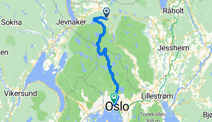
Gruastasjon til Majorstuen
A cycling route starting in Grua, Oppland, Norway.
Overview
About this route
- 4 h 40 min
- Duration
- 62.5 km
- Distance
- 956 m
- Ascent
- 1,266 m
- Descent
- 13.4 km/h
- Avg. speed
- 555 m
- Max. altitude

Route quality
Waytypes & surfaces along the route
Waytypes
Quiet road
43.1 km
(69 %)
Road
9.4 km
(15 %)
Surfaces
Paved
9.4 km
(15 %)
Unpaved
43.1 km
(69 %)
Gravel
30.6 km
(49 %)
Unpaved (undefined)
11.2 km
(18 %)
Continue with Bikemap
Use, edit, or download this cycling route
You would like to ride Gruastasjon til Majorstuen or customize it for your own trip? Here is what you can do with this Bikemap route:
Free features
- Save this route as favorite or in collections
- Copy & plan your own version of this route
- Sync your route with Garmin or Wahoo
Premium features
Free trial for 3 days, or one-time payment. More about Bikemap Premium.
- Navigate this route on iOS & Android
- Export a GPX / KML file of this route
- Create your custom printout (try it for free)
- Download this route for offline navigation
Discover more Premium features.
Get Bikemap PremiumFrom our community
Other popular routes starting in Grua
 Dzień 2 ( 11 lipca )-parking przy szosie>obóz w lesie
- Distance
- 122.4 km
- Ascent
- 716 m
- Descent
- 906 m
- Location
- Grua, Oppland, Norway
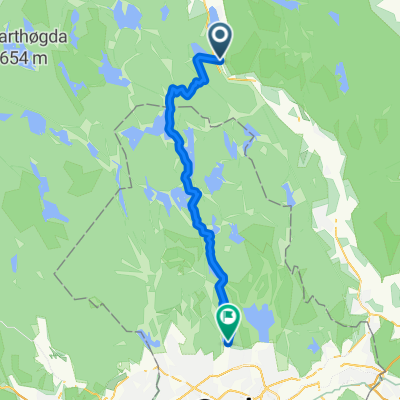
 Granittvegen to Fjellsjøvegen 286-280
- Distance
- 42.7 km
- Ascent
- 759 m
- Descent
- 608 m
- Location
- Grua, Oppland, Norway
 Stryken - Sognsvann
- Distance
- 31.5 km
- Ascent
- 406 m
- Descent
- 444 m
- Location
- Grua, Oppland, Norway
 Thorbjørnrud hotel, Jevnaker - Harestua st
- Distance
- 26.7 km
- Ascent
- 554 m
- Descent
- 653 m
- Location
- Grua, Oppland, Norway
 Harestua (Train station) - Røa
- Distance
- 40.6 km
- Ascent
- 179 m
- Descent
- 24 m
- Location
- Grua, Oppland, Norway
 Grua - Gjettum gjennom Nordmarka
- Distance
- 55.2 km
- Ascent
- 0 m
- Descent
- 0 m
- Location
- Grua, Oppland, Norway
 Gruastasjon til Majorstuen
- Distance
- 62.5 km
- Ascent
- 956 m
- Descent
- 1,266 m
- Location
- Grua, Oppland, Norway
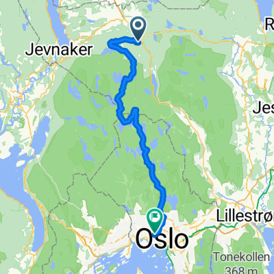
 Harestua - Jevnaker
- Distance
- 25.8 km
- Ascent
- 561 m
- Descent
- 664 m
- Location
- Grua, Oppland, Norway
Open it in the app