

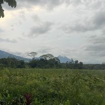
De San Ramón a San Ramón
A cycling route starting in Poco Sol, Alajuela Province, Costa Rica.
Overview
About this route
- 6 h 25 min
- Duration
- 20.4 km
- Distance
- 120 m
- Ascent
- 120 m
- Descent
- 3.2 km/h
- Avg. speed
- 129 m
- Max. altitude

Route quality
Waytypes & surfaces along the route
Waytypes
Quiet road
15.7 km
(77 %)
Road
1.4 km
(7 %)
Undefined
3.3 km
(16 %)
Surfaces
Paved
4.7 km
(23 %)
Asphalt
4.7 km
(23 %)
Undefined
15.7 km
(77 %)
Continue with Bikemap
Use, edit, or download this cycling route
You would like to ride De San Ramón a San Ramón or customize it for your own trip? Here is what you can do with this Bikemap route:
Free features
- Save this route as favorite or in collections
- Copy & plan your own version of this route
- Sync your route with Garmin or Wahoo
Premium features
Free trial for 3 days, or one-time payment. More about Bikemap Premium.
- Navigate this route on iOS & Android
- Export a GPX / KML file of this route
- Create your custom printout (try it for free)
- Download this route for offline navigation
Discover more Premium features.
Get Bikemap PremiumFrom our community
Other popular routes starting in Poco Sol
 poder 2
- Distance
- 55.2 km
- Ascent
- 542 m
- Descent
- 542 m
- Location
- Poco Sol, Alajuela Province, Costa Rica
 Paseo lento
- Distance
- 18.1 km
- Ascent
- 333 m
- Descent
- 353 m
- Location
- Poco Sol, Alajuela Province, Costa Rica
 Tigra
Tigra- Distance
- 12.9 km
- Ascent
- 211 m
- Descent
- 185 m
- Location
- Poco Sol, Alajuela Province, Costa Rica
 poder
poder- Distance
- 14.9 km
- Ascent
- 334 m
- Descent
- 368 m
- Location
- Poco Sol, Alajuela Province, Costa Rica
 Recovered Route
- Distance
- 12.2 km
- Ascent
- 512 m
- Descent
- 357 m
- Location
- Poco Sol, Alajuela Province, Costa Rica
 Chachagua Invu Calle Rojas
- Distance
- 13.5 km
- Ascent
- 275 m
- Descent
- 261 m
- Location
- Poco Sol, Alajuela Province, Costa Rica
 Lago Arenal ida y vuelta desde Poder
- Distance
- 70.9 km
- Ascent
- 743 m
- Descent
- 743 m
- Location
- Poco Sol, Alajuela Province, Costa Rica
 2011.06.02 - National Championships Costa Rica T.T.
- Distance
- 40.1 km
- Ascent
- 113 m
- Descent
- 120 m
- Location
- Poco Sol, Alajuela Province, Costa Rica
Open it in the app