

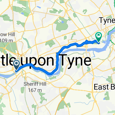
Ride to Ferry Terminal
A cycling route starting in Gateshead, England, United Kingdom.
Overview
About this route
- 59 min
- Duration
- 14.4 km
- Distance
- 92 m
- Ascent
- 87 m
- Descent
- 14.7 km/h
- Avg. speed
- 29 m
- Max. altitude

Route photos

Route quality
Waytypes & surfaces along the route
Waytypes
Cycleway
8.7 km
(60 %)
Quiet road
2.5 km
(17 %)
Surfaces
Paved
11.1 km
(77 %)
Asphalt
10.8 km
(75 %)
Paved (undefined)
0.3 km
(2 %)
Undefined
3.3 km
(23 %)
Continue with Bikemap
Use, edit, or download this cycling route
You would like to ride Ride to Ferry Terminal or customize it for your own trip? Here is what you can do with this Bikemap route:
Free features
- Save this route as favorite or in collections
- Copy & plan your own version of this route
- Sync your route with Garmin or Wahoo
Premium features
Free trial for 3 days, or one-time payment. More about Bikemap Premium.
- Navigate this route on iOS & Android
- Export a GPX / KML file of this route
- Create your custom printout (try it for free)
- Download this route for offline navigation
Discover more Premium features.
Get Bikemap PremiumFrom our community
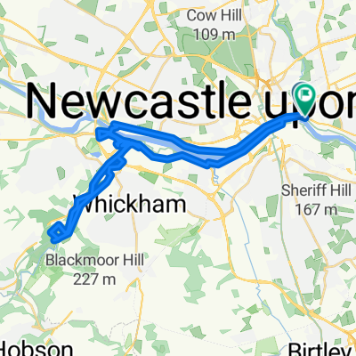
Other popular routes starting in Gateshead
 kirkley loop
- Distance
- 65.4 km
- Ascent
- 245 m
- Descent
- 245 m
- Location
- Gateshead, England, United Kingdom
 Newcastle - Salturn by the sea
- Distance
- 111.5 km
- Ascent
- 399 m
- Descent
- 420 m
- Location
- Gateshead, England, United Kingdom
 Easy ride in Gateshead
- Distance
- 9.7 km
- Ascent
- 163 m
- Descent
- 118 m
- Location
- Gateshead, England, United Kingdom
 Hadrian's Wall Path, Newcastle Upon Tyne nach Coble Dene, North Tyneside
- Distance
- 14 km
- Ascent
- 79 m
- Descent
- 64 m
- Location
- Gateshead, England, United Kingdom
 Derwent walk, Tanfield MTB
- Distance
- 29.6 km
- Ascent
- 277 m
- Descent
- 278 m
- Location
- Gateshead, England, United Kingdom
 Tyne and Derwent
- Distance
- 30.1 km
- Ascent
- 104 m
- Descent
- 99 m
- Location
- Gateshead, England, United Kingdom
 Slow ride in North Shields
- Distance
- 19.2 km
- Ascent
- 103 m
- Descent
- 177 m
- Location
- Gateshead, England, United Kingdom
 Gateshead to Ponteland
- Distance
- 23.5 km
- Ascent
- 107 m
- Descent
- 119 m
- Location
- Gateshead, England, United Kingdom
Open it in the app