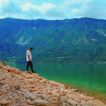
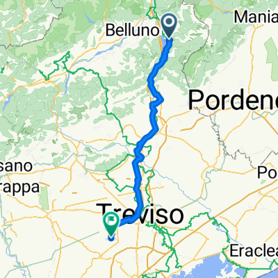
Vajont
A cycling route starting in Farra d'Alpago, Veneto, Italy.
Overview
About this route
- 6 h 5 min
- Duration
- 41.4 km
- Distance
- 890 m
- Ascent
- 793 m
- Descent
- 6.8 km/h
- Avg. speed
- 940 m
- Max. altitude
Route photos
Route quality
Waytypes & surfaces along the route
Waytypes
Road
8.7 km
(21 %)
Cycleway
8.7 km
(21 %)
Surfaces
Paved
33.1 km
(80 %)
Unpaved
3.7 km
(9 %)
Asphalt
33.1 km
(80 %)
Gravel
2.1 km
(5 %)
Continue with Bikemap
Use, edit, or download this cycling route
You would like to ride Vajont or customize it for your own trip? Here is what you can do with this Bikemap route:
Free features
- Save this route as favorite or in collections
- Copy & plan your own version of this route
- Sync your route with Garmin or Wahoo
Premium features
Free trial for 3 days, or one-time payment. More about Bikemap Premium.
- Navigate this route on iOS & Android
- Export a GPX / KML file of this route
- Create your custom printout (try it for free)
- Download this route for offline navigation
Discover more Premium features.
Get Bikemap PremiumFrom our community
Other popular routes starting in Farra d'Alpago
Da Viale Europa a Viale Al Lago- Distance
- 5.9 km
- Ascent
- 175 m
- Descent
- 225 m
- Location
- Farra d'Alpago, Veneto, Italy
Lago die Croce- Distance
- 58.8 km
- Ascent
- 1,213 m
- Descent
- 1,215 m
- Location
- Farra d'Alpago, Veneto, Italy
Giro2016 14.etape- Distance
- 215.7 km
- Ascent
- 4,277 m
- Descent
- 3,139 m
- Location
- Farra d'Alpago, Veneto, Italy
Malga mezzomiglio- Distance
- 8.2 km
- Ascent
- 831 m
- Descent
- 11 m
- Location
- Farra d'Alpago, Veneto, Italy
Da Viale Europa a Viale Al Lago- Distance
- 5.9 km
- Ascent
- 175 m
- Descent
- 225 m
- Location
- Farra d'Alpago, Veneto, Italy
9. Etappe_Lagi di Santa Croce-Treviso- Distance
- 82.1 km
- Ascent
- 219 m
- Descent
- 591 m
- Location
- Farra d'Alpago, Veneto, Italy
Cappuccino-Tour Bad Tölz - Venedig Etappe 4- Distance
- 84.8 km
- Ascent
- 121 m
- Descent
- 510 m
- Location
- Farra d'Alpago, Veneto, Italy
Farra d'Alpago gravel/mtb- Distance
- 63.1 km
- Ascent
- 1,372 m
- Descent
- 1,372 m
- Location
- Farra d'Alpago, Veneto, Italy
Open it in the app


