

4. Tag Rhone
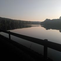
A cycling route starting in Condrieu, Auvergne-Rhône-Alpes, France.
Overview
About this route
- -:--
- Duration
- 50.1 km
- Distance
- 204 m
- Ascent
- 336 m
- Descent
- ---
- Avg. speed
- 357 m
- Max. altitude

Route quality
Waytypes & surfaces along the route
Waytypes
Cycleway
28.2 km
(56 %)
Quiet road
9.1 km
(18 %)
Surfaces
Paved
37.2 km
(74 %)
Unpaved
0.5 km
(<1 %)
Asphalt
36.8 km
(73 %)
Ground
0.5 km
(<1 %)
Continue with Bikemap
Use, edit, or download this cycling route
You would like to ride 4. Tag Rhone or customize it for your own trip? Here is what you can do with this Bikemap route:
Free features
- Save this route as favorite or in collections
- Copy & plan your own version of this route
- Sync your route with Garmin or Wahoo
Premium features
Free trial for 3 days, or one-time payment. More about Bikemap Premium.
- Navigate this route on iOS & Android
- Export a GPX / KML file of this route
- Create your custom printout (try it for free)
- Download this route for offline navigation
Discover more Premium features.
Get Bikemap PremiumFrom our community
Other popular routes starting in Condrieu
 b1 Via Rhona au départ de Condrieu
- Distance
- 45.6 km
- Ascent
- 211 m
- Descent
- 214 m
- Location
- Condrieu, Auvergne-Rhône-Alpes, France
 05777-1107-Condrieu-Chavanay-Pelussin-Doizieux-Chuyer-Condrieu
- Distance
- 55.2 km
- Ascent
- 1,496 m
- Descent
- 1,212 m
- Location
- Condrieu, Auvergne-Rhône-Alpes, France
 4. Tag Rhone
- Distance
- 50.1 km
- Ascent
- 204 m
- Descent
- 336 m
- Location
- Condrieu, Auvergne-Rhône-Alpes, France
 condri
- Distance
- 12.4 km
- Ascent
- 28 m
- Descent
- 27 m
- Location
- Condrieu, Auvergne-Rhône-Alpes, France
 ViaRhona-5
- Distance
- 79.4 km
- Ascent
- 219 m
- Descent
- 235 m
- Location
- Condrieu, Auvergne-Rhône-Alpes, France
 J4C RC2MIPIM 2018
- Distance
- 31.2 km
- Ascent
- 35 m
- Descent
- 47 m
- Location
- Condrieu, Auvergne-Rhône-Alpes, France
 Condrieu, Vienne
- Distance
- 18.3 km
- Ascent
- 140 m
- Descent
- 125 m
- Location
- Condrieu, Auvergne-Rhône-Alpes, France
 Ile du Beurre - Montélimar (FR-MA9)
- Distance
- 160 km
- Ascent
- 35 m
- Descent
- 111 m
- Location
- Condrieu, Auvergne-Rhône-Alpes, France
Open it in the app