

Reddish Vale, Brinnington/Portwood, Stockport Road
A cycling route starting in Burnage, England, United Kingdom.
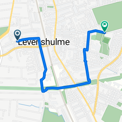
Overview
About this route
- 1 h 2 min
- Duration
- 12.4 km
- Distance
- 93 m
- Ascent
- 90 m
- Descent
- 12.1 km/h
- Avg. speed
- 85 m
- Max. altitude

Route photos


Continue with Bikemap
Use, edit, or download this cycling route
You would like to ride Reddish Vale, Brinnington/Portwood, Stockport Road or customize it for your own trip? Here is what you can do with this Bikemap route:
Free features
- Save this route as favorite or in collections
- Copy & plan your own version of this route
- Sync your route with Garmin or Wahoo
Premium features
Free trial for 3 days, or one-time payment. More about Bikemap Premium.
- Navigate this route on iOS & Android
- Export a GPX / KML file of this route
- Create your custom printout (try it for free)
- Download this route for offline navigation
Discover more Premium features.
Get Bikemap PremiumFrom our community
Other popular routes starting in Burnage
 Fallowfield Loop, Ashton Canal, City Centre, Wilmslow Road
- Distance
- 20.9 km
- Ascent
- 344 m
- Descent
- 345 m
- Location
- Burnage, England, United Kingdom
 Chesterfield Cycle Route
- Distance
- 2.6 km
- Ascent
- 24 m
- Descent
- 0 m
- Location
- Burnage, England, United Kingdom
 Cheadle / Brickworks / Middlewood Way
- Distance
- 39.6 km
- Ascent
- 442 m
- Descent
- 354 m
- Location
- Burnage, England, United Kingdom
 Beech Range to Barlow Road/Broom Lane
- Distance
- 2.2 km
- Ascent
- 3 m
- Descent
- 0 m
- Location
- Burnage, England, United Kingdom
 281 Slade Lane, Manchester to 166 Longford Road West, Stockport
- Distance
- 2.2 km
- Ascent
- 25 m
- Descent
- 6 m
- Location
- Burnage, England, United Kingdom
 To Dunham Massey
- Distance
- 44.8 km
- Ascent
- 108 m
- Descent
- 108 m
- Location
- Burnage, England, United Kingdom
 Around to Marple and back
- Distance
- 54.8 km
- Ascent
- 538 m
- Descent
- 541 m
- Location
- Burnage, England, United Kingdom
 Levenshulme - Marple - New Mills - Disley - Levenshulme
- Distance
- 36.4 km
- Ascent
- 242 m
- Descent
- 239 m
- Location
- Burnage, England, United Kingdom
Open it in the app