

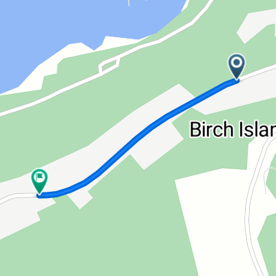
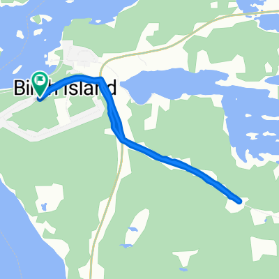
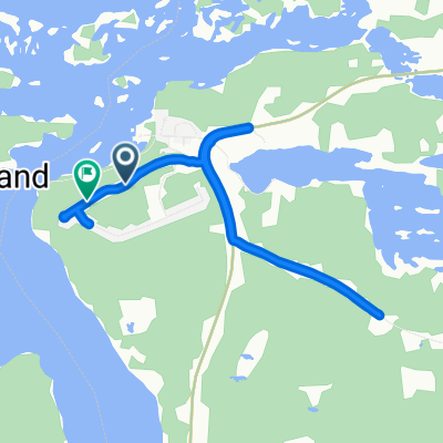
Campbell Street West 90, Little Current to Campbell Street West 90, Little Current
A cycling route starting in Little Current, Ontario, Canada.
Overview
About this route
- 3 h 43 min
- Duration
- 45.5 km
- Distance
- 293 m
- Ascent
- 292 m
- Descent
- 12.2 km/h
- Avg. speed
- 324 m
- Max. altitude

Continue with Bikemap
Use, edit, or download this cycling route
You would like to ride Campbell Street West 90, Little Current to Campbell Street West 90, Little Current or customize it for your own trip? Here is what you can do with this Bikemap route:
Free features
- Save this route as favorite or in collections
- Copy & plan your own version of this route
- Sync your route with Garmin or Wahoo
Premium features
Free trial for 3 days, or one-time payment. More about Bikemap Premium.
- Navigate this route on iOS & Android
- Export a GPX / KML file of this route
- Create your custom printout (try it for free)
- Download this route for offline navigation
Discover more Premium features.
Get Bikemap PremiumFrom our community
Other popular routes starting in Little Current
 20 Blake St W, Northeastern Manitoulin and the Islands to 9950–9974 Highway 6, Northeastern Manitoulin and the Islands
- Distance
- 11.9 km
- Ascent
- 83 m
- Descent
- 55 m
- Location
- Little Current, Ontario, Canada
 tour sheguindha
- Distance
- 57.1 km
- Ascent
- 380 m
- Descent
- 380 m
- Location
- Little Current, Ontario, Canada
 Rainbow Ridge Rd, Whitefish River (Part) 4 to Rainbow Ridge Rd, Whitefish River (Part) 4
- Distance
- 0.8 km
- Ascent
- 3 m
- Descent
- 3 m
- Location
- Little Current, Ontario, Canada
 13 Blake St W, Northeastern Manitoulin and the Islands to 6 Blake St W, Northeastern Manitoulin and the Islands
- Distance
- 15.5 km
- Ascent
- 77 m
- Descent
- 77 m
- Location
- Little Current, Ontario, Canada
 Rainbow Ridge Rd, Whitefish River (Part) 4 to Rainbow Ridge Rd, Whitefish River (Part) 4
- Distance
- 6.4 km
- Ascent
- 93 m
- Descent
- 99 m
- Location
- Little Current, Ontario, Canada
 13 Blake St W, Northeastern Manitoulin and the Islands to 24 Blake St E, Northeastern Manitoulin and the Islands
- Distance
- 17.5 km
- Ascent
- 85 m
- Descent
- 80 m
- Location
- Little Current, Ontario, Canada
 Rainbow Ridge Rd, Whitefish River (Part) 4 to Rainbow Ridge Rd, Whitefish River (Part) 4
- Distance
- 8.4 km
- Ascent
- 54 m
- Descent
- 59 m
- Location
- Little Current, Ontario, Canada
 67–89 Limit St, Northeastern Manitoulin and the Islands to 10944 Highway 6, Northeastern Manitoulin and the Islands
- Distance
- 20.5 km
- Ascent
- 284 m
- Descent
- 284 m
- Location
- Little Current, Ontario, Canada
Open it in the app