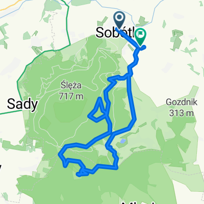
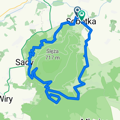
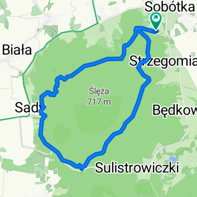
Runda po Ślężańskich singlach (nieoficjalnych)
A cycling route starting in Sobótka, Lower Silesian Voivodeship, Poland.
Overview
About this route
Single (lub ich fragmenty): "Żmija", "Dolce Vita", "Plasterki 2", "Huzarowy" i "Huzarowy 2".
- -:--
- Duration
- 25.1 km
- Distance
- 696 m
- Ascent
- 695 m
- Descent
- ---
- Avg. speed
- 502 m
- Max. altitude
Continue with Bikemap
Use, edit, or download this cycling route
You would like to ride Runda po Ślężańskich singlach (nieoficjalnych) or customize it for your own trip? Here is what you can do with this Bikemap route:
Free features
- Save this route as favorite or in collections
- Copy & plan your own version of this route
- Sync your route with Garmin or Wahoo
Premium features
Free trial for 3 days, or one-time payment. More about Bikemap Premium.
- Navigate this route on iOS & Android
- Export a GPX / KML file of this route
- Create your custom printout (try it for free)
- Download this route for offline navigation
Discover more Premium features.
Get Bikemap PremiumFrom our community
Other popular routes starting in Sobótka
- 1 c tour de sobótka
- Distance
- 44.5 km
- Ascent
- 299 m
- Descent
- 299 m
- Location
- Sobótka, Lower Silesian Voivodeship, Poland
- chujnia po dziurach
- Distance
- 21 km
- Ascent
- 337 m
- Descent
- 337 m
- Location
- Sobótka, Lower Silesian Voivodeship, Poland
- OdLOTTOwa 100-wka z OSHEE i Huzarem wokół Ślęży
- Distance
- 100 km
- Ascent
- 514 m
- Descent
- 514 m
- Location
- Sobótka, Lower Silesian Voivodeship, Poland
- Przy Tamie 4, Borzygniew do Przy Tamie 4, Borzygniew
- Distance
- 18.7 km
- Ascent
- 109 m
- Descent
- 160 m
- Location
- Sobótka, Lower Silesian Voivodeship, Poland
- Propozycja trasy MTB trasy dla klientów Green eBikes
- Distance
- 33.3 km
- Ascent
- 582 m
- Descent
- 582 m
- Location
- Sobótka, Lower Silesian Voivodeship, Poland
- MTB #1 - propozycja trasy od GreeneBikes.pl
- Distance
- 34 km
- Ascent
- 2,670 m
- Descent
- 2,670 m
- Location
- Sobótka, Lower Silesian Voivodeship, Poland
- Dookoła Ślęży z wjazdem na szczyt
- Distance
- 27.5 km
- Ascent
- 581 m
- Descent
- 580 m
- Location
- Sobótka, Lower Silesian Voivodeship, Poland
- radunia+ślęża
- Distance
- 15.5 km
- Ascent
- 614 m
- Descent
- 614 m
- Location
- Sobótka, Lower Silesian Voivodeship, Poland
Open it in the app