

AutenriedAmmerseeHerrsching
A cycling route starting in Rieden an der Kötz, Bavaria, Germany.
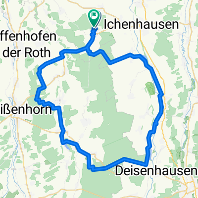
Overview
About this route
- -:--
- Duration
- 109.6 km
- Distance
- 1,109 m
- Ascent
- 1,051 m
- Descent
- ---
- Avg. speed
- 661 m
- Max. altitude

Route quality
Waytypes & surfaces along the route
Waytypes
Quiet road
39.5 km
(36 %)
Road
30.7 km
(28 %)
Surfaces
Paved
86.6 km
(79 %)
Unpaved
6.6 km
(6 %)
Asphalt
83.3 km
(76 %)
Gravel
4.4 km
(4 %)
Continue with Bikemap
Use, edit, or download this cycling route
You would like to ride AutenriedAmmerseeHerrsching or customize it for your own trip? Here is what you can do with this Bikemap route:
Free features
- Save this route as favorite or in collections
- Copy & plan your own version of this route
- Split it into stages to create a multi-day tour
- Sync your route with Garmin or Wahoo
Premium features
Free trial for 3 days, or one-time payment. More about Bikemap Premium.
- Navigate this route on iOS & Android
- Export a GPX / KML file of this route
- Create your custom printout (try it for free)
- Download this route for offline navigation
Discover more Premium features.
Get Bikemap PremiumFrom our community
Other popular routes starting in Rieden an der Kötz
 Kleine Tour durch's Bibertal
- Distance
- 25.4 km
- Ascent
- 127 m
- Descent
- 109 m
- Location
- Rieden an der Kötz, Bavaria, Germany
 Autenried-Babenhausen-Kellmünz-Autenried
- Distance
- 92.3 km
- Ascent
- 644 m
- Descent
- 641 m
- Location
- Rieden an der Kötz, Bavaria, Germany
 GRAVEL-Autenried-Kalvarienberg-Silbersee-Günzburg-Autenried
- Distance
- 75.2 km
- Ascent
- 640 m
- Descent
- 634 m
- Location
- Rieden an der Kötz, Bavaria, Germany
 Graveltour-Autenried-Roggenburg-Marienfried-Autenried
- Distance
- 45.7 km
- Ascent
- 457 m
- Descent
- 451 m
- Location
- Rieden an der Kötz, Bavaria, Germany
 Autenried-Wasserberg-Burg-Autenried Gravel
- Distance
- 96.5 km
- Ascent
- 473 m
- Descent
- 471 m
- Location
- Rieden an der Kötz, Bavaria, Germany
 Autenried-Wasserberg-Ebershausen
- Distance
- 100.7 km
- Ascent
- 891 m
- Descent
- 892 m
- Location
- Rieden an der Kötz, Bavaria, Germany
 Große Bibertalroute
- Distance
- 42.5 km
- Ascent
- 170 m
- Descent
- 170 m
- Location
- Rieden an der Kötz, Bavaria, Germany
 2-Täler-Runde
- Distance
- 22.5 km
- Ascent
- 201 m
- Descent
- 202 m
- Location
- Rieden an der Kötz, Bavaria, Germany
Open it in the app