

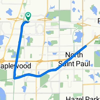
1175 County Road D E, Vadnais Heights to 1175 County Road D E, Vadnais Heights
A cycling route starting in Vadnais Heights, Minnesota, United States.
Overview
About this route
- 1 h 18 min
- Duration
- 35 km
- Distance
- 578 m
- Ascent
- 591 m
- Descent
- 26.8 km/h
- Avg. speed
- 302 m
- Max. altitude

Route quality
Waytypes & surfaces along the route
Waytypes
Cycleway
21 km
(60 %)
Road
9.1 km
(26 %)
Surfaces
Paved
20.7 km
(59 %)
Asphalt
17.9 km
(51 %)
Paved (undefined)
2.1 km
(6 %)
Continue with Bikemap
Use, edit, or download this cycling route
You would like to ride 1175 County Road D E, Vadnais Heights to 1175 County Road D E, Vadnais Heights or customize it for your own trip? Here is what you can do with this Bikemap route:
Free features
- Save this route as favorite or in collections
- Copy & plan your own version of this route
- Sync your route with Garmin or Wahoo
Premium features
Free trial for 3 days, or one-time payment. More about Bikemap Premium.
- Navigate this route on iOS & Android
- Export a GPX / KML file of this route
- Create your custom printout (try it for free)
- Download this route for offline navigation
Discover more Premium features.
Get Bikemap PremiumFrom our community
Other popular routes starting in Vadnais Heights
 B2B00159 55127 > 55449 via rice, lexington, and cty rd j
- Distance
- 15.3 km
- Ascent
- 9 m
- Descent
- 16 m
- Location
- Vadnais Heights, Minnesota, United States
 Rick's house around White Bear Lake
- Distance
- 26.9 km
- Ascent
- 103 m
- Descent
- 97 m
- Location
- Vadnais Heights, Minnesota, United States
 B2B00457 55127>55110 Centervl/GooseLk/Hoffman/WhiteBear/S.Shore/Century
- Distance
- 11.9 km
- Ascent
- 61 m
- Descent
- 29 m
- Location
- Vadnais Heights, Minnesota, United States
 45.036° N -93.052° W to 45.065° N -93.024° W
- Distance
- 33 km
- Ascent
- 239 m
- Descent
- 243 m
- Location
- Vadnais Heights, Minnesota, United States
 B2B00395 55127>55101 viaCenterville/Edgerton/Gateway/L'Orient/Jackson
- Distance
- 16.8 km
- Ascent
- 41 m
- Descent
- 85 m
- Location
- Vadnais Heights, Minnesota, United States
 1587 County Road D E, Maplewood to 1599 County Road D E, Maplewood
- Distance
- 20.1 km
- Ascent
- 96 m
- Descent
- 95 m
- Location
- Vadnais Heights, Minnesota, United States
 The Great Fall Bike Ride
- Distance
- 230.4 km
- Ascent
- 241 m
- Descent
- 229 m
- Location
- Vadnais Heights, Minnesota, United States
 B2B00457 55127>55110 Centervl/GooseLk/Hoffman/WhiteBear/S.Shore/Century
- Distance
- 11.8 km
- Ascent
- 75 m
- Descent
- 39 m
- Location
- Vadnais Heights, Minnesota, United States
Open it in the app