
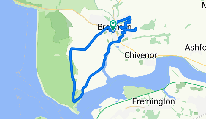
ride around
A cycling route starting in Braunton, England, United Kingdom.
Overview
About this route
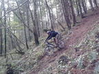
really nice ride , good views once out the top of the village
- -:--
- Duration
- 16.2 km
- Distance
- 146 m
- Ascent
- 143 m
- Descent
- ---
- Avg. speed
- ---
- Max. altitude
Route quality
Waytypes & surfaces along the route
Waytypes
Quiet road
9.1 km
(56 %)
Track
5.5 km
(34 %)
Surfaces
Paved
0.9 km
(6 %)
Unpaved
3.5 km
(22 %)
Unpaved (undefined)
3.2 km
(20 %)
Asphalt
0.9 km
(5 %)
Continue with Bikemap
Use, edit, or download this cycling route
You would like to ride ride around or customize it for your own trip? Here is what you can do with this Bikemap route:
Free features
- Save this route as favorite or in collections
- Copy & plan your own version of this route
- Sync your route with Garmin or Wahoo
Premium features
Free trial for 3 days, or one-time payment. More about Bikemap Premium.
- Navigate this route on iOS & Android
- Export a GPX / KML file of this route
- Create your custom printout (try it for free)
- Download this route for offline navigation
Discover more Premium features.
Get Bikemap PremiumFrom our community
Other popular routes starting in Braunton
 1 st ride out
- Distance
- 18.9 km
- Ascent
- 55 m
- Descent
- 55 m
- Location
- Braunton, England, United Kingdom
 braunton-trail centre
- Distance
- 12.7 km
- Ascent
- 288 m
- Descent
- 124 m
- Location
- Braunton, England, United Kingdom
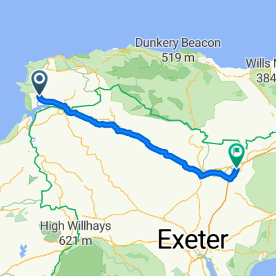
 Long ride over exmoor
- Distance
- 141 km
- Ascent
- 2,180 m
- Descent
- 2,182 m
- Location
- Braunton, England, United Kingdom
 pint and a coffee
- Distance
- 25 km
- Ascent
- 370 m
- Descent
- 367 m
- Location
- Braunton, England, United Kingdom
 Tarka Trail
- Distance
- 48.7 km
- Ascent
- 233 m
- Descent
- 152 m
- Location
- Braunton, England, United Kingdom
 braunton to m5
- Distance
- 71.1 km
- Ascent
- 609 m
- Descent
- 528 m
- Location
- Braunton, England, United Kingdom
 pint
pint- Distance
- 14.5 km
- Ascent
- 200 m
- Descent
- 199 m
- Location
- Braunton, England, United Kingdom
 sunday ride out 2
- Distance
- 21.6 km
- Ascent
- 376 m
- Descent
- 376 m
- Location
- Braunton, England, United Kingdom
Open it in the app