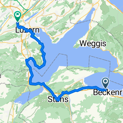
day 4 PART 2 AUTOFAHRE-ERSTFELD
A cycling route starting in Beckenried, Canton of Nidwalden, Switzerland.
Overview
About this route
- -:--
- Duration
- 35.3 km
- Distance
- 942 m
- Ascent
- 908 m
- Descent
- ---
- Avg. speed
- 617 m
- Avg. speed
Route quality
Waytypes & surfaces along the route
Waytypes
Undefined
35.3 km
(100 %)
Surfaces
Undefined
35.3 km
(100 %)
Route highlights
Points of interest along the route
Point of interest after 12.5 km
le corbusier
Continue with Bikemap
Use, edit, or download this cycling route
You would like to ride day 4 PART 2 AUTOFAHRE-ERSTFELD or customize it for your own trip? Here is what you can do with this Bikemap route:
Free features
- Save this route as favorite or in collections
- Copy & plan your own version of this route
- Sync your route with Garmin or Wahoo
Premium features
Free trial for 3 days, or one-time payment. More about Bikemap Premium.
- Navigate this route on iOS & Android
- Export a GPX / KML file of this route
- Create your custom printout (try it for free)
- Download this route for offline navigation
Discover more Premium features.
Get Bikemap PremiumFrom our community
Other popular routes starting in Beckenried
- Dorfplatz 1, Beckenried to Altdorfstrasse 33, Vitznau
- Distance
- 5.4 km
- Ascent
- 0 m
- Descent
- 0 m
- Location
- Beckenried, Canton of Nidwalden, Switzerland
- Oberdorfstrasse 28, Beckenried nach Bachstrasse 9, Gersau
- Distance
- 59.5 km
- Ascent
- 1,356 m
- Descent
- 1,402 m
- Location
- Beckenried, Canton of Nidwalden, Switzerland
- Reuss 2 bis Luzern
- Distance
- 30.5 km
- Ascent
- 487 m
- Descent
- 493 m
- Location
- Beckenried, Canton of Nidwalden, Switzerland
- Dorfstrasse 51, Beckenried nach Seestrasse 5, Unterägeri
- Distance
- 36.8 km
- Ascent
- 715 m
- Descent
- 420 m
- Location
- Beckenried, Canton of Nidwalden, Switzerland
- vacs j10 suite
- Distance
- 27.7 km
- Ascent
- 516 m
- Descent
- 519 m
- Location
- Beckenried, Canton of Nidwalden, Switzerland
- Switzerland: Day 3
- Distance
- 140.8 km
- Ascent
- 3,163 m
- Descent
- 2,431 m
- Location
- Beckenried, Canton of Nidwalden, Switzerland
- Tag_2_-_ZZ_Transalp_Brunnen_-_Engstlenalp
- Distance
- 40.8 km
- Ascent
- 1,799 m
- Descent
- 402 m
- Location
- Beckenried, Canton of Nidwalden, Switzerland
- Beckenried - Engelberg
- Distance
- 25.8 km
- Ascent
- 601 m
- Descent
- 34 m
- Location
- Beckenried, Canton of Nidwalden, Switzerland