

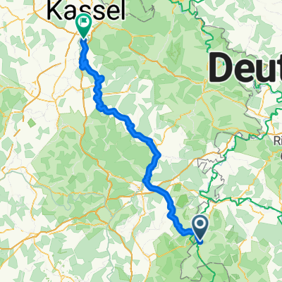
3. Geisa - Bad Hersfeld 55km
A cycling route starting in Geisa, Thuringia, Germany.
Overview
About this route
- -:--
- Duration
- 54.9 km
- Distance
- 359 m
- Ascent
- 459 m
- Descent
- ---
- Avg. speed
- 362 m
- Max. altitude

Route quality
Waytypes & surfaces along the route
Waytypes
Path
19.2 km
(35 %)
Track
15.9 km
(29 %)
Surfaces
Paved
48.9 km
(89 %)
Unpaved
2.7 km
(5 %)
Asphalt
42.8 km
(78 %)
Concrete
5.5 km
(10 %)
Continue with Bikemap
Use, edit, or download this cycling route
You would like to ride 3. Geisa - Bad Hersfeld 55km or customize it for your own trip? Here is what you can do with this Bikemap route:
Free features
- Save this route as favorite or in collections
- Copy & plan your own version of this route
- Sync your route with Garmin or Wahoo
Premium features
Free trial for 3 days, or one-time payment. More about Bikemap Premium.
- Navigate this route on iOS & Android
- Export a GPX / KML file of this route
- Create your custom printout (try it for free)
- Download this route for offline navigation
Discover more Premium features.
Get Bikemap PremiumFrom our community
Other popular routes starting in Geisa
 Rhöntour
- Distance
- 47.7 km
- Ascent
- 877 m
- Descent
- 877 m
- Location
- Geisa, Thuringia, Germany
 3. Geisa - Bad Hersfeld 55km
- Distance
- 54.9 km
- Ascent
- 359 m
- Descent
- 459 m
- Location
- Geisa, Thuringia, Germany
 Tag 2
Tag 2- Distance
- 20.1 km
- Ascent
- 486 m
- Descent
- 485 m
- Location
- Geisa, Thuringia, Germany
 Von Geisa bis Hofbieber
- Distance
- 32.9 km
- Ascent
- 686 m
- Descent
- 187 m
- Location
- Geisa, Thuringia, Germany
 D8: Geisa - Fuldabrück
- Distance
- 102.8 km
- Ascent
- 748 m
- Descent
- 848 m
- Location
- Geisa, Thuringia, Germany
 Geisa - Hünfeld 28
- Distance
- 22.8 km
- Ascent
- 425 m
- Descent
- 422 m
- Location
- Geisa, Thuringia, Germany
 BR-Kanz-Lämm-BR
- Distance
- 23.9 km
- Ascent
- 563 m
- Descent
- 565 m
- Location
- Geisa, Thuringia, Germany
 Geisa - Eisenach
- Distance
- 70.8 km
- Ascent
- 234 m
- Descent
- 300 m
- Location
- Geisa, Thuringia, Germany
Open it in the app