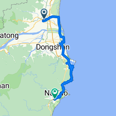
環島D7
A cycling route starting in Yilan, Taiwan, Taiwan.
Overview
About this route
- -:--
- Duration
- 112.2 km
- Distance
- 408 m
- Ascent
- 396 m
- Descent
- ---
- Avg. speed
- ---
- Avg. speed
Route highlights
Points of interest along the route
Point of interest after 18.1 km
大溪車站=18km
Point of interest after 34 km
三貂角燈塔入口=34km
Point of interest after 43.6 km
福隆=44km
Point of interest after 49.6 km
澳底=50km
Point of interest after 59.8 km
鼻頭腳休息區=60km
Point of interest after 81.7 km
基隆港務局=82km
Point of interest after 95.9 km
廖書=96km
Continue with Bikemap
Use, edit, or download this cycling route
You would like to ride 環島D7 or customize it for your own trip? Here is what you can do with this Bikemap route:
Free features
- Save this route as favorite or in collections
- Copy & plan your own version of this route
- Split it into stages to create a multi-day tour
- Sync your route with Garmin or Wahoo
Premium features
Free trial for 3 days, or one-time payment. More about Bikemap Premium.
- Navigate this route on iOS & Android
- Export a GPX / KML file of this route
- Create your custom printout (try it for free)
- Download this route for offline navigation
Discover more Premium features.
Get Bikemap PremiumFrom our community
Other popular routes starting in Yilan
- 北宜公路
- Distance
- 57.4 km
- Ascent
- 954 m
- Descent
- 951 m
- Location
- Yilan, Taiwan, Taiwan
- 980502_桶后林道
- Distance
- 11.8 km
- Ascent
- 625 m
- Descent
- 418 m
- Location
- Yilan, Taiwan, Taiwan
- 小鐵人宜蘭兩日20160424
- Distance
- 63.8 km
- Ascent
- 1,085 m
- Descent
- 1,078 m
- Location
- Yilan, Taiwan, Taiwan
- 橫越中央山脈一豎,台7甲,台14甲,台21,台18線
- Distance
- 409.2 km
- Ascent
- 6,042 m
- Descent
- 6,044 m
- Location
- Yilan, Taiwan, Taiwan
- 北濱公路 : 宜蘭市->內湖 101km
- Distance
- 101.7 km
- Ascent
- 567 m
- Descent
- 550 m
- Location
- Yilan, Taiwan, Taiwan
- 北濱公路
- Distance
- 155.9 km
- Ascent
- 368 m
- Descent
- 367 m
- Location
- Yilan, Taiwan, Taiwan
- 太平山
- Distance
- 35.5 km
- Ascent
- 2,002 m
- Descent
- 247 m
- Location
- Yilan, Taiwan, Taiwan
- Day 9 Tai Wan
- Distance
- 81.8 km
- Ascent
- 228 m
- Descent
- 180 m
- Location
- Yilan, Taiwan, Taiwan
Open it in the app