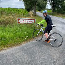
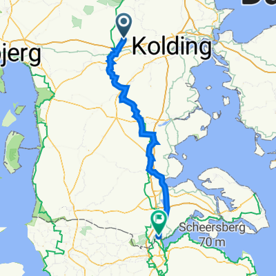
Gesten til æ Græns
A cycling route starting in Vejen Municipality, Region South Denmark, Denmark.
Overview
About this route
- 6 h 33 min
- Duration
- 104.4 km
- Distance
- 242 m
- Ascent
- 258 m
- Descent
- 16 km/h
- Avg. speed
- 66 m
- Avg. speed
Route quality
Waytypes & surfaces along the route
Waytypes
Quiet road
52.1 km
(50 %)
Road
27.1 km
(26 %)
Surfaces
Paved
86.1 km
(82 %)
Unpaved
17.6 km
(17 %)
Asphalt
86.1 km
(82 %)
Gravel
17.6 km
(17 %)
Continue with Bikemap
Use, edit, or download this cycling route
You would like to ride Gesten til æ Græns or customize it for your own trip? Here is what you can do with this Bikemap route:
Free features
- Save this route as favorite or in collections
- Copy & plan your own version of this route
- Sync your route with Garmin or Wahoo
Premium features
Free trial for 3 days, or one-time payment. More about Bikemap Premium.
- Navigate this route on iOS & Android
- Export a GPX / KML file of this route
- Create your custom printout (try it for free)
- Download this route for offline navigation
Discover more Premium features.
Get Bikemap PremiumFrom our community
Other popular routes starting in Vejen Municipality
- Vejen-Vijens
- Distance
- 40.5 km
- Ascent
- 114 m
- Descent
- 112 m
- Location
- Vejen Municipality, Region South Denmark, Denmark
- Fra Gesten til grænsen
- Distance
- 109.3 km
- Ascent
- 553 m
- Descent
- 584 m
- Location
- Vejen Municipality, Region South Denmark, Denmark
- 18km cykelrute, 3g Idræt B MiniTri
- Distance
- 18 km
- Ascent
- 86 m
- Descent
- 86 m
- Location
- Vejen Municipality, Region South Denmark, Denmark
- Forårstur26/02/12
- Distance
- 40.6 km
- Ascent
- 147 m
- Descent
- 152 m
- Location
- Vejen Municipality, Region South Denmark, Denmark
- Gesten til æ Græns
- Distance
- 104.4 km
- Ascent
- 242 m
- Descent
- 258 m
- Location
- Vejen Municipality, Region South Denmark, Denmark
- Flensburg - Frederikshavn Teil 3
- Distance
- 88.6 km
- Ascent
- 550 m
- Descent
- 542 m
- Location
- Vejen Municipality, Region South Denmark, Denmark
- Bække til varde - til fods
- Distance
- 59.7 km
- Ascent
- 66 m
- Descent
- 126 m
- Location
- Vejen Municipality, Region South Denmark, Denmark
- Vejen - Scherrebek/Skaerbaek
- Distance
- 53.2 km
- Ascent
- 147 m
- Descent
- 174 m
- Location
- Vejen Municipality, Region South Denmark, Denmark
Open it in the app