

Szombathely - Kőszeg - Szent Vid - Szombathely
A cycling route starting in Gencsapáti, Vas County, Hungary.
Overview
About this route
Szombathely - Bozsok - Bucsu - Kőszegszerdahely - Velem - Cák - Kőszeg - Molnárhegy - Hétforrás - Stájer házak - Szent Vid kápolna - Velem - Kőszegszerdahely - Bucsu - Bozsok - Szombathely
- -:--
- Duration
- 79.7 km
- Distance
- 734 m
- Ascent
- 733 m
- Descent
- ---
- Avg. speed
- ---
- Max. altitude
Route quality
Waytypes & surfaces along the route
Waytypes
Quiet road
25.5 km
(32 %)
Road
17.5 km
(22 %)
Surfaces
Paved
63.7 km
(80 %)
Unpaved
6.4 km
(8 %)
Asphalt
51 km
(64 %)
Paved (undefined)
12.7 km
(16 %)
Continue with Bikemap
Use, edit, or download this cycling route
You would like to ride Szombathely - Kőszeg - Szent Vid - Szombathely or customize it for your own trip? Here is what you can do with this Bikemap route:
Free features
- Save this route as favorite or in collections
- Copy & plan your own version of this route
- Sync your route with Garmin or Wahoo
Premium features
Free trial for 3 days, or one-time payment. More about Bikemap Premium.
- Navigate this route on iOS & Android
- Export a GPX / KML file of this route
- Create your custom printout (try it for free)
- Download this route for offline navigation
Discover more Premium features.
Get Bikemap PremiumFrom our community
Other popular routes starting in Gencsapáti
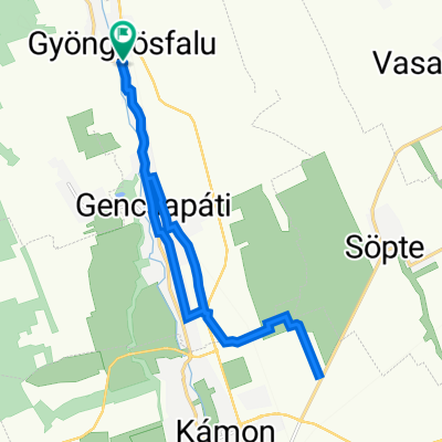 Petőfi Sándor utca 124, Gyöngyösfalu - Petőfi Sándor utca 124, Gyöngyösfalu
- Distance
- 17.7 km
- Ascent
- 258 m
- Descent
- 315 m
- Location
- Gencsapáti, Vas County, Hungary
 Gencs-Lockenhaus-Rechnitz-Szombathely
- Distance
- 83 km
- Ascent
- 669 m
- Descent
- 676 m
- Location
- Gencsapáti, Vas County, Hungary
 Route from Petőfi Sándor utca 2, Bucsu
- Distance
- 209.6 km
- Ascent
- 1,561 m
- Descent
- 1,681 m
- Location
- Gencsapáti, Vas County, Hungary
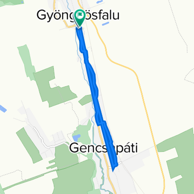 8721 124, Gyöngyösfalu to Petőfi Sándor utca 122, Gyöngyösfalu
- Distance
- 6.7 km
- Ascent
- 33 m
- Descent
- 31 m
- Location
- Gencsapáti, Vas County, Hungary
 Kerékpáros élménytúra a pinkaóvári fürdőtóhoz
- Distance
- 44.6 km
- Ascent
- 178 m
- Descent
- 181 m
- Location
- Gencsapáti, Vas County, Hungary
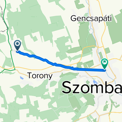 87133, Bucsu - Paragvári utca 106, Szombathely
- Distance
- 8.9 km
- Ascent
- 7 m
- Descent
- 62 m
- Location
- Gencsapáti, Vas County, Hungary
 Szombathely - Kőszeg - Szent Vid - Szombathely
- Distance
- 79.7 km
- Ascent
- 734 m
- Descent
- 733 m
- Location
- Gencsapáti, Vas County, Hungary
 8721 124, Gyöngyösfalu - Petőfi Sándor utca 124, Gyöngyösfalu
- Distance
- 4.8 km
- Ascent
- 14 m
- Descent
- 16 m
- Location
- Gencsapáti, Vas County, Hungary
Open it in the app