

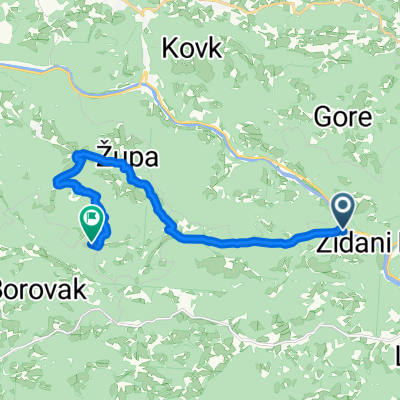
Zidani Most - Zagreb -Slavonski Brod
A cycling route starting in Radeče, Radeče Municipality, Slovenia.
Overview
About this route
Bahn:
Wien - Lubljana - Triest EC 151
Slavonski Brod - Zagreb
- -:--
- Duration
- 295 km
- Distance
- 1,071 m
- Ascent
- 1,198 m
- Descent
- ---
- Avg. speed
- 236 m
- Max. altitude

Route quality
Waytypes & surfaces along the route
Waytypes
Road
44.3 km
(15 %)
Quiet road
23.6 km
(8 %)
Surfaces
Paved
271.4 km
(92 %)
Unpaved
8.9 km
(3 %)
Asphalt
271.4 km
(92 %)
Gravel
8.9 km
(3 %)
Undefined
14.8 km
(5 %)
Continue with Bikemap
Use, edit, or download this cycling route
You would like to ride Zidani Most - Zagreb -Slavonski Brod or customize it for your own trip? Here is what you can do with this Bikemap route:
Free features
- Save this route as favorite or in collections
- Copy & plan your own version of this route
- Split it into stages to create a multi-day tour
- Sync your route with Garmin or Wahoo
Premium features
Free trial for 3 days, or one-time payment. More about Bikemap Premium.
- Navigate this route on iOS & Android
- Export a GPX / KML file of this route
- Create your custom printout (try it for free)
- Download this route for offline navigation
Discover more Premium features.
Get Bikemap PremiumFrom our community
Other popular routes starting in Radeče
 1: Na Lisco
- Distance
- 29.6 km
- Ascent
- 911 m
- Descent
- 910 m
- Location
- Radeče, Radeče Municipality, Slovenia
 podkraj-kum
- Distance
- 12.5 km
- Ascent
- 1,167 m
- Descent
- 257 m
- Location
- Radeče, Radeče Municipality, Slovenia
 PANTARCA 3B
- Distance
- 62.7 km
- Ascent
- 543 m
- Descent
- 867 m
- Location
- Radeče, Radeče Municipality, Slovenia
 Zidani Most - Zagreb -Slavonski Brod
- Distance
- 295 km
- Ascent
- 1,071 m
- Descent
- 1,198 m
- Location
- Radeče, Radeče Municipality, Slovenia
 Jagnjenica-Podkum-Polšnik-Pasjek-Mamolj-Velika Preska-Čeplje-Dole-Sopota
- Distance
- 65.1 km
- Ascent
- 2,018 m
- Descent
- 2,021 m
- Location
- Radeče, Radeče Municipality, Slovenia
 Zidani Most-Logarska Dolina
- Distance
- 97.2 km
- Ascent
- 982 m
- Descent
- 175 m
- Location
- Radeče, Radeče Municipality, Slovenia
 Dravinja 21. 3. dan Radeče = Šmartno pri Litiji
- Distance
- 39.7 km
- Ascent
- 363 m
- Descent
- 768 m
- Location
- Radeče, Radeče Municipality, Slovenia
 Loka - Radež
- Distance
- 3.1 km
- Ascent
- 288 m
- Descent
- 24 m
- Location
- Radeče, Radeče Municipality, Slovenia
Open it in the app