

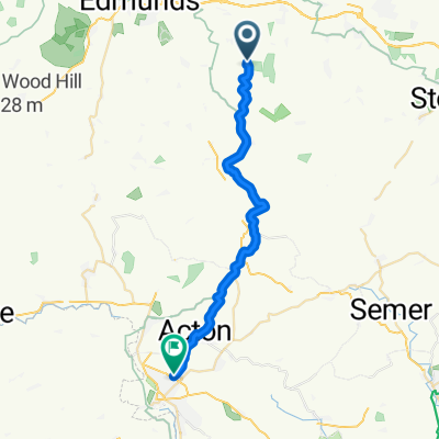
Birch Road Thurston to High Street 113A
A cycling route starting in Thurston, England, United Kingdom.
Overview
About this route
- 3 h 19 min
- Duration
- 54.8 km
- Distance
- 309 m
- Ascent
- 345 m
- Descent
- 16.6 km/h
- Avg. speed
- 109 m
- Max. altitude

Route quality
Waytypes & surfaces along the route
Waytypes
Road
40.5 km
(74 %)
Cycleway
9.3 km
(17 %)
Surfaces
Paved
8.8 km
(16 %)
Asphalt
8.8 km
(16 %)
Undefined
46 km
(84 %)
Continue with Bikemap
Use, edit, or download this cycling route
You would like to ride Birch Road Thurston to High Street 113A or customize it for your own trip? Here is what you can do with this Bikemap route:
Free features
- Save this route as favorite or in collections
- Copy & plan your own version of this route
- Sync your route with Garmin or Wahoo
Premium features
Free trial for 3 days, or one-time payment. More about Bikemap Premium.
- Navigate this route on iOS & Android
- Export a GPX / KML file of this route
- Create your custom printout (try it for free)
- Download this route for offline navigation
Discover more Premium features.
Get Bikemap PremiumFrom our community
Other popular routes starting in Thurston
 Bennet Arms to Claydon
- Distance
- 33.5 km
- Ascent
- 126 m
- Descent
- 188 m
- Location
- Thurston, England, United Kingdom
 Plantation Farmhouse
- Distance
- 63.3 km
- Ascent
- 163 m
- Descent
- 176 m
- Location
- Thurston, England, United Kingdom
 Tostock loop
- Distance
- 9.7 km
- Ascent
- 11 m
- Descent
- 56 m
- Location
- Thurston, England, United Kingdom
 Bennet Arms, Woolpit, Felsham
- Distance
- 22.7 km
- Ascent
- 106 m
- Descent
- 104 m
- Location
- Thurston, England, United Kingdom
 A14, Rougham, Bury St Edmunds to 9 Heather Close, Bury St. Edmunds
- Distance
- 3.2 km
- Ascent
- 3 m
- Descent
- 16 m
- Location
- Thurston, England, United Kingdom
 Bennet Arms to Pakenham Fox1
- Distance
- 23.8 km
- Ascent
- 68 m
- Descent
- 68 m
- Location
- Thurston, England, United Kingdom
 Friday night training
- Distance
- 32.3 km
- Ascent
- 129 m
- Descent
- 127 m
- Location
- Thurston, England, United Kingdom
 Supersonic route in Sudbury
- Distance
- 23.6 km
- Ascent
- 10 m
- Descent
- 65 m
- Location
- Thurston, England, United Kingdom
Open it in the app