

Day 6 - Llangollen to Clatterbridge
A cycling route starting in Llangollen, Wales, United Kingdom.
Overview
About this route
- -:--
- Duration
- 76.4 km
- Distance
- 695 m
- Ascent
- 719 m
- Descent
- ---
- Avg. speed
- ---
- Max. altitude

Continue with Bikemap
Use, edit, or download this cycling route
You would like to ride Day 6 - Llangollen to Clatterbridge or customize it for your own trip? Here is what you can do with this Bikemap route:
Free features
- Save this route as favorite or in collections
- Copy & plan your own version of this route
- Sync your route with Garmin or Wahoo
Premium features
Free trial for 3 days, or one-time payment. More about Bikemap Premium.
- Navigate this route on iOS & Android
- Export a GPX / KML file of this route
- Create your custom printout (try it for free)
- Download this route for offline navigation
Discover more Premium features.
Get Bikemap PremiumFrom our community
Other popular routes starting in Llangollen
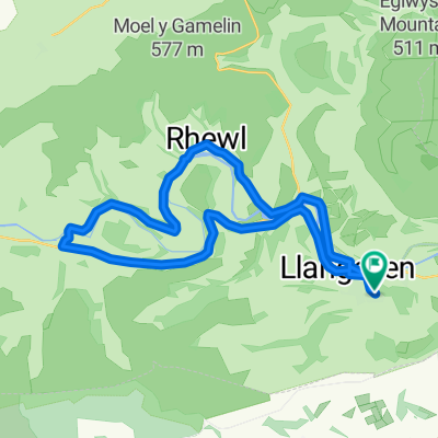 Restful route in Llangollen
- Distance
- 22.8 km
- Ascent
- 488 m
- Descent
- 489 m
- Location
- Llangollen, Wales, United Kingdom
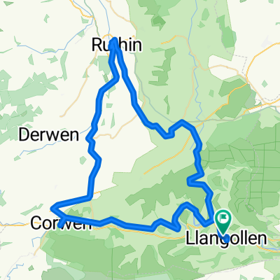 Llangollen
- Distance
- 65.9 km
- Ascent
- 663 m
- Descent
- 663 m
- Location
- Llangollen, Wales, United Kingdom
 Llangollen Loop
- Distance
- 80 km
- Ascent
- 863 m
- Descent
- 864 m
- Location
- Llangollen, Wales, United Kingdom
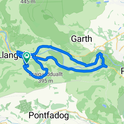 6 Maes Pengwern, Llangollen to 6 Maes Pengwern, Llangollen
- Distance
- 18 km
- Ascent
- 259 m
- Descent
- 261 m
- Location
- Llangollen, Wales, United Kingdom
 Pandy loop
- Distance
- 71.5 km
- Ascent
- 1,274 m
- Descent
- 1,267 m
- Location
- Llangollen, Wales, United Kingdom
 home over 3 peaks horseshoe and back
- Distance
- 29.4 km
- Ascent
- 750 m
- Descent
- 747 m
- Location
- Llangollen, Wales, United Kingdom
 HORSESHOE PASS, por Llangollen
- Distance
- 6.1 km
- Ascent
- 395 m
- Descent
- 83 m
- Location
- Llangollen, Wales, United Kingdom
 llangollen loop 2
- Distance
- 78.6 km
- Ascent
- 1,714 m
- Descent
- 1,723 m
- Location
- Llangollen, Wales, United Kingdom
Open it in the app