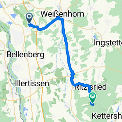
Landkreise Neu-Ulm und GĂŒnzburg
A cycling route starting in Vöhringen, Bavaria, Germany.
Overview
About this route
- -:--
- Duration
- 79.9 km
- Distance
- 359 m
- Ascent
- 350 m
- Descent
- ---
- Avg. speed
- 573 m
- Max. altitude
Route quality
Waytypes & surfaces along the route
Waytypes
Quiet road
29.2 km
(37 %)
Road
16.3 km
(20 %)
Surfaces
Paved
71.3 km
(89 %)
Unpaved
0.9 km
(1 %)
Asphalt
70.1 km
(88 %)
Paved (undefined)
1.2 km
(1 %)
Continue with Bikemap
Use, edit, or download this cycling route
You would like to ride Landkreise Neu-Ulm und GĂŒnzburg or customize it for your own trip? Here is what you can do with this Bikemap route:
Free features
- Save this route as favorite or in collections
- Copy & plan your own version of this route
- Sync your route with Garmin or Wahoo
Premium features
Free trial for 3 days, or one-time payment. More about Bikemap Premium.
- Navigate this route on iOS & Android
- Export a GPX / KML file of this route
- Create your custom printout (try it for free)
- Download this route for offline navigation
Discover more Premium features.
Get Bikemap PremiumFrom our community
Other popular routes starting in Vöhringen
- Training auf der Alb
- Distance
- 104.4 km
- Ascent
- 675 m
- Descent
- 674 m
- Location
- Vöhringen, Bavaria, Germany
- Sonntagstour
- Distance
- 31 km
- Ascent
- 275 m
- Descent
- 277 m
- Location
- Vöhringen, Bavaria, Germany
- Nach WeiĂingen(Radlerwirtschaft) und zurĂŒck
- Distance
- 64.5 km
- Ascent
- 175 m
- Descent
- 175 m
- Location
- Vöhringen, Bavaria, Germany
- Radtour Illertal - GĂŒnztal
- Distance
- 108.2 km
- Ascent
- 389 m
- Descent
- 389 m
- Location
- Vöhringen, Bavaria, Germany
- GemĂŒhtliche Abendrunde
- Distance
- 29.7 km
- Ascent
- 91 m
- Descent
- 94 m
- Location
- Vöhringen, Bavaria, Germany
- nette runde
- Distance
- 49.4 km
- Ascent
- 129 m
- Descent
- 154 m
- Location
- Vöhringen, Bavaria, Germany
- Landkreise Neu-Ulm und GĂŒnzburg
- Distance
- 79.9 km
- Ascent
- 359 m
- Descent
- 350 m
- Location
- Vöhringen, Bavaria, Germany
- IZ stille Wasser
- Distance
- 58.6 km
- Ascent
- 105 m
- Descent
- 105 m
- Location
- Vöhringen, Bavaria, Germany
Open it in the app