

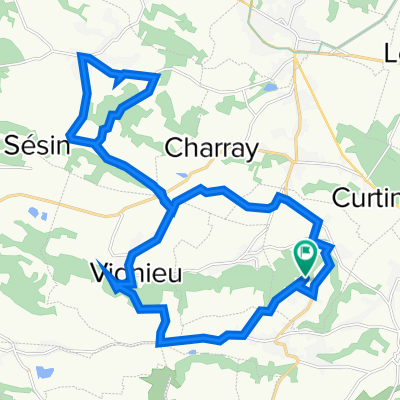
Creys
A cycling route starting in Curtin, Auvergne-Rhône-Alpes, France.
Overview
About this route
- 2 h 20 min
- Duration
- 35.6 km
- Distance
- 451 m
- Ascent
- 455 m
- Descent
- 15.2 km/h
- Avg. speed
- 430 m
- Max. altitude

Route quality
Waytypes & surfaces along the route
Waytypes
Quiet road
12.1 km
(34 %)
Road
11 km
(31 %)
Surfaces
Paved
2.8 km
(8 %)
Asphalt
2.8 km
(8 %)
Undefined
32.7 km
(92 %)
Continue with Bikemap
Use, edit, or download this cycling route
You would like to ride Creys or customize it for your own trip? Here is what you can do with this Bikemap route:
Free features
- Save this route as favorite or in collections
- Copy & plan your own version of this route
- Sync your route with Garmin or Wahoo
Premium features
Free trial for 3 days, or one-time payment. More about Bikemap Premium.
- Navigate this route on iOS & Android
- Export a GPX / KML file of this route
- Create your custom printout (try it for free)
- Download this route for offline navigation
Discover more Premium features.
Get Bikemap PremiumFrom our community
Other popular routes starting in Curtin
 Brangues
- Distance
- 31.8 km
- Ascent
- 364 m
- Descent
- 364 m
- Location
- Curtin, Auvergne-Rhône-Alpes, France
 Sermerieux
- Distance
- 27.5 km
- Ascent
- 434 m
- Descent
- 436 m
- Location
- Curtin, Auvergne-Rhône-Alpes, France
 220 Rue Saint-Martin, Vézeronce-Curtin à 220 Rue Saint-Martin, Vézeronce-Curtin
- Distance
- 10.5 km
- Ascent
- 245 m
- Descent
- 250 m
- Location
- Curtin, Auvergne-Rhône-Alpes, France
 Bas Cuirieu
- Distance
- 32.7 km
- Ascent
- 409 m
- Descent
- 410 m
- Location
- Curtin, Auvergne-Rhône-Alpes, France
 Vézeronce-Curtin à 21 Route des Alpes, Sablons
- Distance
- 95.8 km
- Ascent
- 538 m
- Descent
- 611 m
- Location
- Curtin, Auvergne-Rhône-Alpes, France
 Savoie, Barrage Champagnieux
- Distance
- 48.1 km
- Ascent
- 346 m
- Descent
- 392 m
- Location
- Curtin, Auvergne-Rhône-Alpes, France
 Briprd
- Distance
- 50.6 km
- Ascent
- 396 m
- Descent
- 394 m
- Location
- Curtin, Auvergne-Rhône-Alpes, France
 dolomieu Faverges
- Distance
- 25.5 km
- Ascent
- 377 m
- Descent
- 378 m
- Location
- Curtin, Auvergne-Rhône-Alpes, France
Open it in the app