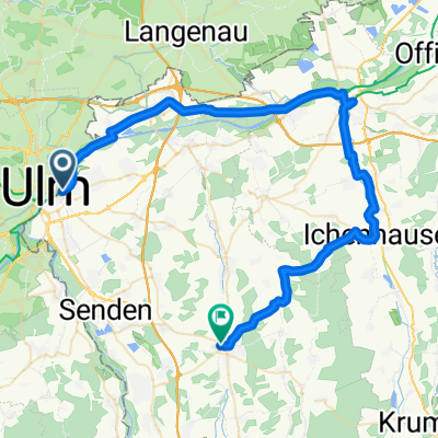
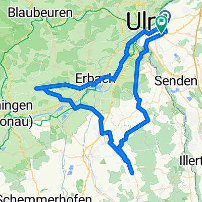
BRT2012-MO: Oberschwaben-Runde - RTF des BRT2012 in Ulm - 110 km Strecke
- 108.7 km
- 295 m
- 295 m
- Neu-Ulm, Bavaria, Germany
A cycling route starting in Neu-Ulm, Bavaria, Germany.
Overview
BRT2012-MO: Oberschwaben-Runde - 110 km
RTF of BRT2012 in Ulm
All further information about this route -> click here
At the start, there was only a very small route map (DIN A5), no time table, and too many twisted arrows on the way. Since the route was signposted differently than what was indicated on the handed-out plan, many were off track. The road was signposted, but on many bike paths that were supposed to be used, the signs were completely missing because they were hung on the road...
It is commendable that some found the right way. Comments like: 'you could have paid better attention' don't really help. I spoke on the way and at the finish with many who, like me, had gotten lost in Unterkirchberg. They were already coming back from Illerrieden and Senden. A construction vehicle had completely covered a directional arrow.
created this 14 years ago
Route quality
Road
37 km
(34 %)
Path
19.6 km
(18 %)
Paved
97.8 km
(90 %)
Unpaved
2.2 km
(2 %)
Asphalt
97.8 km
(90 %)
Gravel
2.2 km
(2 %)
Undefined
8.7 km
(8 %)
Route highlights
Kontrolle <b>Hüttisheim</b> nur für die kleine Runde, an der es keine Verpflegung gibt.
Continue with Bikemap
You would like to ride BRT2012-MO: Oberschwaben-Runde - RTF des BRT2012 in Ulm - 110 km Strecke or customize it for your own trip? Here is what you can do with this Bikemap route:
Free trial for 3 days, or one-time payment. More about Bikemap Premium.
Discover more Premium features.
Get Bikemap PremiumFrom our community
Open it in the app