

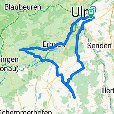
BRT2012-DO: Zwischen Iller und Rot - RTF des BRT2012 in Ulm - 114 km Strecke
A cycling route starting in Neu-Ulm, Bavaria, Germany.
Overview
About this route
BRT2012-DO: Between Iller and Rot - 114 km
RTF of BRT2012 in Ulm
All further information about this route -> click here
Since Monday, very little has changed regarding the signage. With one major exception: the large loop between the control point has been re-signposted with several additional arrows during the event. Otherwise, it remains true: if there is any signposting at all, there is a maximum of one directional arrow per turn. For every km that participants have gone off course today, one euro, and I wouldn’t need to work for a long time.
There is also something special to report: the person responsible for the route got lost right in front of our group of at least 8 participants from various clubs by following a very well-placed directional arrow and ended up, like all of us, on the wrong street at km 19.
- -:--
- Duration
- 108.9 km
- Distance
- 384 m
- Ascent
- 384 m
- Descent
- ---
- Avg. speed
- ---
- Max. altitude

Route quality
Waytypes & surfaces along the route
Waytypes
Road
38.1 km
(35 %)
Path
26.1 km
(24 %)
Surfaces
Paved
88.2 km
(81 %)
Unpaved
2.2 km
(2 %)
Asphalt
87.1 km
(80 %)
Paved (undefined)
1.1 km
(1 %)
Route highlights
Points of interest along the route

Point of interest after 40.4 km
Kontrolle <b>Vöhringen</b> wird zweimal angesteuert und ist die einzige Verpflegungs- und Kontrollstelle auf der langen Strecke.
Continue with Bikemap
Use, edit, or download this cycling route
You would like to ride BRT2012-DO: Zwischen Iller und Rot - RTF des BRT2012 in Ulm - 114 km Strecke or customize it for your own trip? Here is what you can do with this Bikemap route:
Free features
- Save this route as favorite or in collections
- Copy & plan your own version of this route
- Split it into stages to create a multi-day tour
- Sync your route with Garmin or Wahoo
Premium features
Free trial for 3 days, or one-time payment. More about Bikemap Premium.
- Navigate this route on iOS & Android
- Export a GPX / KML file of this route
- Create your custom printout (try it for free)
- Download this route for offline navigation
Discover more Premium features.
Get Bikemap PremiumFrom our community
Other popular routes starting in Neu-Ulm
 BRT2012-FR: Über die Alb und entlang des Kliffs - RTF des BRT2012 in Ulm - 42 km Strecke
- Distance
- 39.8 km
- Ascent
- 274 m
- Descent
- 274 m
- Location
- Neu-Ulm, Bavaria, Germany
 Max-Eyth-Straße 351/2 nach St2029
- Distance
- 78.4 km
- Ascent
- 476 m
- Descent
- 474 m
- Location
- Neu-Ulm, Bavaria, Germany
 Radtour P15 25.06.2011
- Distance
- 64.9 km
- Ascent
- 246 m
- Descent
- 246 m
- Location
- Neu-Ulm, Bavaria, Germany
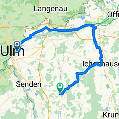
 BRT2012-DO: Zwischen Iller und Rot - RTF des BRT2012 in Ulm - 71 km Strecke
- Distance
- 71.5 km
- Ascent
- 209 m
- Descent
- 209 m
- Location
- Neu-Ulm, Bavaria, Germany
 ULM-26-E3-Günzburg-Weißenhorn
- Distance
- 53.9 km
- Ascent
- 248 m
- Descent
- 223 m
- Location
- Neu-Ulm, Bavaria, Germany
 BRT2012-DO: Zwischen Iller und Rot - RTF des BRT2012 in Ulm - 114 km Strecke
- Distance
- 108.9 km
- Ascent
- 384 m
- Descent
- 384 m
- Location
- Neu-Ulm, Bavaria, Germany
 BRT2012-FR: Über die Alb und entlang des Kliffs - RTF des BRT2012 in Ulm - 107 km Strecke
- Distance
- 102.8 km
- Ascent
- 525 m
- Descent
- 525 m
- Location
- Neu-Ulm, Bavaria, Germany
 BRT2012-MI: Drei-Täler-Tour - RTF des BRT2012 in Ulm - 103 km Strecke
- Distance
- 126 km
- Ascent
- 611 m
- Descent
- 610 m
- Location
- Neu-Ulm, Bavaria, Germany
Open it in the app