

Ulm - Stuttgart Hbf
A cycling route starting in Dornstadt, Baden-Württemberg, Germany.
Overview
About this route
Tour für Rennrad von Ulm (Jungingen) nach Stuttgart Hbf. Hügelig bis Hochdorf, dann flach nach Stuttgart rein.
- -:--
- Duration
- 90.3 km
- Distance
- 409 m
- Ascent
- 754 m
- Descent
- ---
- Avg. speed
- ---
- Avg. speed
Route quality
Waytypes & surfaces along the route
Waytypes
Road
27.9 km
(31 %)
Busy road
23.4 km
(26 %)
Surfaces
Paved
68.6 km
(76 %)
Unpaved
0.4 km
(<1 %)
Asphalt
63.1 km
(70 %)
Paving stones
3.7 km
(4 %)
Continue with Bikemap
Use, edit, or download this cycling route
You would like to ride Ulm - Stuttgart Hbf or customize it for your own trip? Here is what you can do with this Bikemap route:
Free features
- Save this route as favorite or in collections
- Copy & plan your own version of this route
- Split it into stages to create a multi-day tour
- Sync your route with Garmin or Wahoo
Premium features
Free trial for 3 days, or one-time payment. More about Bikemap Premium.
- Navigate this route on iOS & Android
- Export a GPX / KML file of this route
- Create your custom printout (try it for free)
- Download this route for offline navigation
Discover more Premium features.
Get Bikemap PremiumFrom our community
Other popular routes starting in Dornstadt
 Sonntags Runde
- Distance
- 19.6 km
- Ascent
- 436 m
- Descent
- 429 m
- Location
- Dornstadt, Baden-Württemberg, Germany
 Angenehme, kurze Trainingsrunde
- Distance
- 14.8 km
- Ascent
- 91 m
- Descent
- 90 m
- Location
- Dornstadt, Baden-Württemberg, Germany
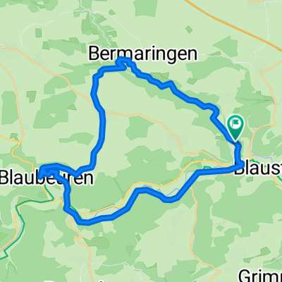
 Ulm - Lautertal - Blaubeuren - Allewind - Butzental - Ulm
- Distance
- 41.8 km
- Ascent
- 411 m
- Descent
- 541 m
- Location
- Dornstadt, Baden-Württemberg, Germany
 Tomerdingen-BleicherWalk
- Distance
- 15.1 km
- Ascent
- 46 m
- Descent
- 186 m
- Location
- Dornstadt, Baden-Württemberg, Germany
 Große Abendrunde ins Tiefental
- Distance
- 56.9 km
- Ascent
- 717 m
- Descent
- 767 m
- Location
- Dornstadt, Baden-Württemberg, Germany
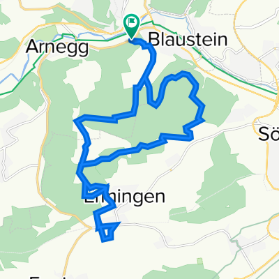
 Herrlingen - Kleines Lauter Tal - Blautopf - Gerhausen - Arnegg
- Distance
- 30 km
- Ascent
- 642 m
- Descent
- 648 m
- Location
- Dornstadt, Baden-Württemberg, Germany
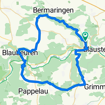 Blaustein 14/6
- Distance
- 36.7 km
- Ascent
- 653 m
- Descent
- 559 m
- Location
- Dornstadt, Baden-Württemberg, Germany
 Kleine Lautertal 8
- Distance
- 27.8 km
- Ascent
- 423 m
- Descent
- 354 m
- Location
- Dornstadt, Baden-Württemberg, Germany
Open it in the app