
- Vianden
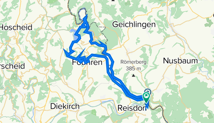
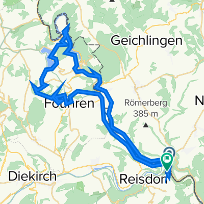
A cycling route starting in Wallendorf, Rhineland-Palatinate, Germany.
Overview
About this route
- -:--
- Duration
- 40.6 km
- Distance
- 882 m
- Ascent
- 837 m
- Descent
- ---
- Avg. speed
- 491 m
- Max. altitude

Route quality
Waytypes & surfaces along the route
Waytypes
Track
15.8 km
(39 %)
Road
9.3 km
(23 %)
Surfaces
Paved
25.2 km
(62 %)
Unpaved
8.5 km
(21 %)
Asphalt
21.9 km
(54 %)
Gravel
4.9 km
(12 %)
Continue with Bikemap
Use, edit, or download this cycling route
You would like to ride - Vianden or customize it for your own trip? Here is what you can do with this Bikemap route:
Free features
- Save this route as favorite or in collections
- Copy & plan your own version of this route
- Sync your route with Garmin or Wahoo
Premium features
Free trial for 3 days, or one-time payment. More about Bikemap Premium.
- Navigate this route on iOS & Android
- Export a GPX / KML file of this route
- Create your custom printout (try it for free)
- Download this route for offline navigation
Discover more Premium features.
Get Bikemap PremiumFrom our community
Other popular routes starting in Wallendorf
 20150822_111902.gpx
- Distance
- 16.4 km
- Ascent
- 242 m
- Descent
- 180 m
- Location
- Wallendorf, Rhineland-Palatinate, Germany
 Tourentipp Beaufort
- Distance
- 10.3 km
- Ascent
- 217 m
- Descent
- 218 m
- Location
- Wallendorf, Rhineland-Palatinate, Germany
 en chemin vers Echternach retour
- Distance
- 15.9 km
- Ascent
- 69 m
- Descent
- 52 m
- Location
- Wallendorf, Rhineland-Palatinate, Germany
 Radtour Trier - Koblenz
- Distance
- 247.4 km
- Ascent
- 90 m
- Descent
- 204 m
- Location
- Wallendorf, Rhineland-Palatinate, Germany
 Wallendorf-Wormeldange
- Distance
- 48.1 km
- Ascent
- 495 m
- Descent
- 535 m
- Location
- Wallendorf, Rhineland-Palatinate, Germany
 Wallendorf-Wasserbillig-Wormeldange
- Distance
- 55.1 km
- Ascent
- 444 m
- Descent
- 483 m
- Location
- Wallendorf, Rhineland-Palatinate, Germany
 VTT berdorf beaufort
- Distance
- 46.8 km
- Ascent
- 1,114 m
- Descent
- 928 m
- Location
- Wallendorf, Rhineland-Palatinate, Germany
 - Vianden
- Distance
- 40.6 km
- Ascent
- 882 m
- Descent
- 837 m
- Location
- Wallendorf, Rhineland-Palatinate, Germany
Open it in the app