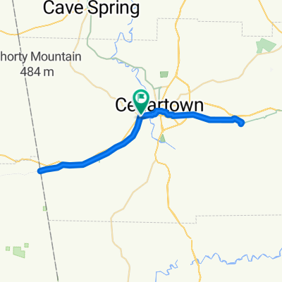
3001–3247 Piedmont Hwy, Cedartown to 6512 Weaver Rd, Anniston
A cycling route starting in Cedartown, Georgia, United States.
Overview
About this route
- 3 h 8 min
- Duration
- 58.5 km
- Distance
- 855 m
- Ascent
- 911 m
- Descent
- 18.7 km/h
- Avg. speed
- 305 m
- Max. altitude
Route quality
Waytypes & surfaces along the route
Waytypes
Cycleway
56.8 km
(97 %)
Quiet road
1.2 km
(2 %)
Undefined
0.6 km
(1 %)
Surfaces
Paved
55.6 km
(95 %)
Paved (undefined)
52.1 km
(89 %)
Concrete
3.5 km
(6 %)
Undefined
2.9 km
(5 %)
Continue with Bikemap
Use, edit, or download this cycling route
You would like to ride 3001–3247 Piedmont Hwy, Cedartown to 6512 Weaver Rd, Anniston or customize it for your own trip? Here is what you can do with this Bikemap route:
Free features
- Save this route as favorite or in collections
- Copy & plan your own version of this route
- Sync your route with Garmin or Wahoo
Premium features
Free trial for 3 days, or one-time payment. More about Bikemap Premium.
- Navigate this route on iOS & Android
- Export a GPX / KML file of this route
- Create your custom printout (try it for free)
- Download this route for offline navigation
Discover more Premium features.
Get Bikemap PremiumFrom our community
Other popular routes starting in Cedartown
Silver Comet, Cedartown to 279 Tucker Blvd, Dallas- Distance
- 44.6 km
- Ascent
- 270 m
- Descent
- 250 m
- Location
- Cedartown, Georgia, United States
3001–3247 Piedmont Hwy, Cedartown to 6512 Weaver Rd, Anniston- Distance
- 58.5 km
- Ascent
- 855 m
- Descent
- 911 m
- Location
- Cedartown, Georgia, United States
Route from 2–20 Galilee Rd, Rockmart- Distance
- 25.7 km
- Ascent
- 232 m
- Descent
- 207 m
- Location
- Cedartown, Georgia, United States
silver comet- Distance
- 18.7 km
- Ascent
- 113 m
- Descent
- 135 m
- Location
- Cedartown, Georgia, United States
754–786 CR-239, Piedmont to 542 Vigo Rd, Piedmont- Distance
- 20.4 km
- Ascent
- 175 m
- Descent
- 253 m
- Location
- Cedartown, Georgia, United States
Silver Comet Trail (Atlanta)- Distance
- 105.3 km
- Ascent
- 412 m
- Descent
- 328 m
- Location
- Cedartown, Georgia, United States
SCT State Line to Trash Mtn- Distance
- 51.9 km
- Ascent
- 390 m
- Descent
- 391 m
- Location
- Cedartown, Georgia, United States
Chief Ladiga Trail- Distance
- 52.6 km
- Ascent
- 180 m
- Descent
- 258 m
- Location
- Cedartown, Georgia, United States
Open it in the app


