
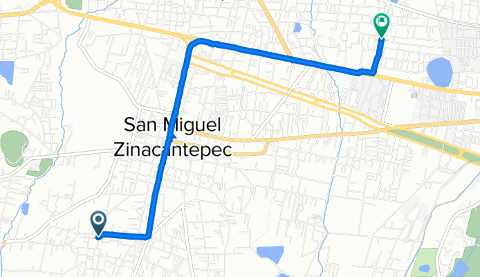
Calle Ignacio Zaragoza 119, San Cristobal Tecolit to Calle Aztecas 131, San Luis Mextepec
A cycling route starting in Cerro del Murciélago, Estado de México, Mexico.
Overview
About this route
- 25 min
- Duration
- 5.8 km
- Distance
- 19 m
- Ascent
- 77 m
- Descent
- 14 km/h
- Avg. speed
- 2,783 m
- Avg. speed

Continue with Bikemap
Use, edit, or download this cycling route
You would like to ride Calle Ignacio Zaragoza 119, San Cristobal Tecolit to Calle Aztecas 131, San Luis Mextepec or customize it for your own trip? Here is what you can do with this Bikemap route:
Free features
- Save this route as favorite or in collections
- Copy & plan your own version of this route
- Sync your route with Garmin or Wahoo
Premium features
Free trial for 3 days, or one-time payment. More about Bikemap Premium.
- Navigate this route on iOS & Android
- Export a GPX / KML file of this route
- Create your custom printout (try it for free)
- Download this route for offline navigation
Discover more Premium features.
Get Bikemap PremiumFrom our community
Other popular routes starting in Cerro del Murciélago
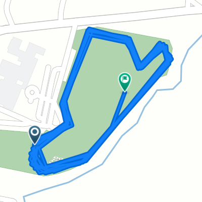 28 marzo
- Distance
- 6.4 km
- Ascent
- 33 m
- Descent
- 38 m
- Location
- Cerro del Murciélago, Estado de México, Mexico
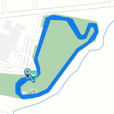 27 marzo
- Distance
- 3.7 km
- Ascent
- 28 m
- Descent
- 31 m
- Location
- Cerro del Murciélago, Estado de México, Mexico
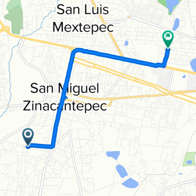 Calle Ignacio Zaragoza 119, San Cristobal Tecolit to Calle Aztecas 131, San Luis Mextepec
- Distance
- 5.8 km
- Ascent
- 19 m
- Descent
- 77 m
- Location
- Cerro del Murciélago, Estado de México, Mexico
Open it in the app