RUNDKURS - Eiterfeld - Ufhausen - Soisdorf - Großentaft - Leibolz - Eiterfeld
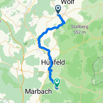
A cycling route starting in Eiterfeld, Hesse, Germany.
Overview
About this route
Rundkurs, der bis zum Befahren des KegelspielRW meist bergab verläuft.
Diese Tour ist zu 100% geteert und somit auch für Rennradfahrer geeignet
- -:--
- Duration
- 23.7 km
- Distance
- 201 m
- Ascent
- 201 m
- Descent
- ---
- Avg. speed
- ---
- Max. altitude
Route quality
Waytypes & surfaces along the route
Waytypes
Quiet road
6.6 km
(28 %)
Path
6.4 km
(27 %)
Surfaces
Paved
20.6 km
(87 %)
Unpaved
0.2 km
(1 %)
Asphalt
15.2 km
(64 %)
Paved (undefined)
5.4 km
(23 %)
Continue with Bikemap
Use, edit, or download this cycling route
You would like to ride RUNDKURS - Eiterfeld - Ufhausen - Soisdorf - Großentaft - Leibolz - Eiterfeld or customize it for your own trip? Here is what you can do with this Bikemap route:
Free features
- Save this route as favorite or in collections
- Copy & plan your own version of this route
- Sync your route with Garmin or Wahoo
Premium features
Free trial for 3 days, or one-time payment. More about Bikemap Premium.
- Navigate this route on iOS & Android
- Export a GPX / KML file of this route
- Create your custom printout (try it for free)
- Download this route for offline navigation
Discover more Premium features.
Get Bikemap PremiumFrom our community
Other popular routes starting in Eiterfeld
- Haunetal - Soisberg - Burghaun
- Distance
- 48.2 km
- Ascent
- 769 m
- Descent
- 769 m
- Location
- Eiterfeld, Hesse, Germany
- Buchenau Stopelsberg Buchenau
- Distance
- 16.7 km
- Ascent
- 305 m
- Descent
- 305 m
- Location
- Eiterfeld, Hesse, Germany
- Bad Hersfeld
- Distance
- 12.5 km
- Ascent
- 135 m
- Descent
- 192 m
- Location
- Eiterfeld, Hesse, Germany
- Schönau a.d.Brend 3-Tage 1
- Distance
- 86.2 km
- Ascent
- 916 m
- Descent
- 911 m
- Location
- Eiterfeld, Hesse, Germany
- Milseburgradweg von Eiterfeld aus
- Distance
- 96.2 km
- Ascent
- 667 m
- Descent
- 676 m
- Location
- Eiterfeld, Hesse, Germany
- Haunetal Burgrunde 01
- Distance
- 34.1 km
- Ascent
- 669 m
- Descent
- 670 m
- Location
- Eiterfeld, Hesse, Germany
- Haunetal-Kirchheim-HEF
- Distance
- 53.1 km
- Ascent
- 428 m
- Descent
- 422 m
- Location
- Eiterfeld, Hesse, Germany
- êò?Ì? nach êò?Ì?
- Distance
- 21.5 km
- Ascent
- 237 m
- Descent
- 234 m
- Location
- Eiterfeld, Hesse, Germany
Open it in the app