

Fast ride in
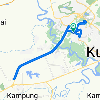
A cycling route starting in Kuantan, Pahang, Malaysia.
Overview
About this route
- 2 h 39 min
- Duration
- 55.8 km
- Distance
- 281 m
- Ascent
- 281 m
- Descent
- 21.1 km/h
- Avg. speed
- 36 m
- Max. altitude

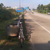
Route photos


Route quality
Waytypes & surfaces along the route
Waytypes
Road
43 km
(77 %)
Quiet road
11.7 km
(21 %)
Access road
1.1 km
(2 %)
Continue with Bikemap
Use, edit, or download this cycling route
You would like to ride Fast ride in or customize it for your own trip? Here is what you can do with this Bikemap route:
Free features
- Save this route as favorite or in collections
- Copy & plan your own version of this route
- Sync your route with Garmin or Wahoo
Premium features
Free trial for 3 days, or one-time payment. More about Bikemap Premium.
- Navigate this route on iOS & Android
- Export a GPX / KML file of this route
- Create your custom printout (try it for free)
- Download this route for offline navigation
Discover more Premium features.
Get Bikemap PremiumFrom our community
Other popular routes starting in Kuantan
 140422 Lorong Balok Baru 1 76, Kuantan to Lorong Balok Baru 1 62, Kuantan
- Distance
- 15.4 km
- Ascent
- 36 m
- Descent
- 33 m
- Location
- Kuantan, Pahang, Malaysia
 Fast ride in
- Distance
- 55.8 km
- Ascent
- 281 m
- Descent
- 281 m
- Location
- Kuantan, Pahang, Malaysia
 Lorong Shahzan IM 5 7, Kuantan to Lorong Shahzan IM 5 7, Kuantan
- Distance
- 27.5 km
- Ascent
- 143 m
- Descent
- 145 m
- Location
- Kuantan, Pahang, Malaysia
 EAST COAST RIDE
- Distance
- 241 km
- Ascent
- 63 m
- Descent
- 68 m
- Location
- Kuantan, Pahang, Malaysia
 130227 - Tour de Langkawi - Stage 07
- Distance
- 157 km
- Ascent
- 187 m
- Descent
- 190 m
- Location
- Kuantan, Pahang, Malaysia
 abcde
abcde- Distance
- 26.6 km
- Ascent
- 674 m
- Descent
- 683 m
- Location
- Kuantan, Pahang, Malaysia
 2016 NiteRide route
- Distance
- 32.4 km
- Ascent
- 108 m
- Descent
- 109 m
- Location
- Kuantan, Pahang, Malaysia
 NYRide40km+
- Distance
- 46.7 km
- Ascent
- 192 m
- Descent
- 193 m
- Location
- Kuantan, Pahang, Malaysia
Open it in the app