

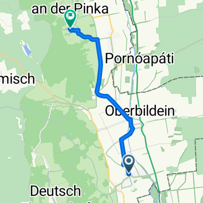
Höll, Deutsch Schützen-Eisenberg nach Punitz, Tobaj
A cycling route starting in Eberau, Burgenland, Austria.
Overview
About this route
- 1 h 7 min
- Duration
- 13.5 km
- Distance
- 276 m
- Ascent
- 199 m
- Descent
- 12.1 km/h
- Avg. speed
- 328 m
- Max. altitude

Continue with Bikemap
Use, edit, or download this cycling route
You would like to ride Höll, Deutsch Schützen-Eisenberg nach Punitz, Tobaj or customize it for your own trip? Here is what you can do with this Bikemap route:
Free features
- Save this route as favorite or in collections
- Copy & plan your own version of this route
- Sync your route with Garmin or Wahoo
Premium features
Free trial for 3 days, or one-time payment. More about Bikemap Premium.
- Navigate this route on iOS & Android
- Export a GPX / KML file of this route
- Create your custom printout (try it for free)
- Download this route for offline navigation
Discover more Premium features.
Get Bikemap PremiumFrom our community
Other popular routes starting in Eberau
 Eberau-Eisenberg-Eberau
- Distance
- 32.9 km
- Ascent
- 278 m
- Descent
- 280 m
- Location
- Eberau, Burgenland, Austria
 2305276-2/2
- Distance
- 26.8 km
- Ascent
- 175 m
- Descent
- 97 m
- Location
- Eberau, Burgenland, Austria
 Eberau - Körmend - Eberau
- Distance
- 36.4 km
- Ascent
- 74 m
- Descent
- 73 m
- Location
- Eberau, Burgenland, Austria
 eberau-eisenberg-eberau
- Distance
- 34.4 km
- Ascent
- 409 m
- Descent
- 407 m
- Location
- Eberau, Burgenland, Austria
 Hauptpl n Oberer Weinweg Wallner
- Distance
- 9.5 km
- Ascent
- 81 m
- Descent
- 0 m
- Location
- Eberau, Burgenland, Austria
 Hauptplatz 32, Eberau nach Hauptplatz 32, Eberau
- Distance
- 10.7 km
- Ascent
- 6 m
- Descent
- 9 m
- Location
- Eberau, Burgenland, Austria
 Höll, Deutsch Schützen-Eisenberg nach Punitz, Tobaj
- Distance
- 13.5 km
- Ascent
- 276 m
- Descent
- 199 m
- Location
- Eberau, Burgenland, Austria
 Hauptplatz 13, Eberau nach Luising 3, Luising
- Distance
- 14 km
- Ascent
- 22 m
- Descent
- 41 m
- Location
- Eberau, Burgenland, Austria
Open it in the app