

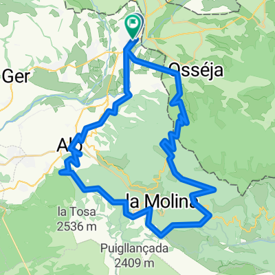
2022 Cat Etapa 1
A cycling route starting in la Guingueta d'Ix, Occitanie, France.
Overview
About this route
- -:--
- Duration
- 42.9 km
- Distance
- 1,265 m
- Ascent
- 1,265 m
- Descent
- ---
- Avg. speed
- 1,914 m
- Max. altitude
Route quality
Waytypes & surfaces along the route
Waytypes
Track
21.9 km
(51 %)
Path
10.3 km
(24 %)
Surfaces
Paved
9.4 km
(22 %)
Unpaved
14.6 km
(34 %)
Ground
11.2 km
(26 %)
Asphalt
9 km
(21 %)
Continue with Bikemap
Use, edit, or download this cycling route
You would like to ride 2022 Cat Etapa 1 or customize it for your own trip? Here is what you can do with this Bikemap route:
Free features
- Save this route as favorite or in collections
- Copy & plan your own version of this route
- Sync your route with Garmin or Wahoo
Premium features
Free trial for 3 days, or one-time payment. More about Bikemap Premium.
- Navigate this route on iOS & Android
- Export a GPX / KML file of this route
- Create your custom printout (try it for free)
- Download this route for offline navigation
Discover more Premium features.
Get Bikemap PremiumFrom our community
Other popular routes starting in la Guingueta d'Ix
 El Palheres
- Distance
- 138.4 km
- Ascent
- 2,806 m
- Descent
- 2,803 m
- Location
- la Guingueta d'Ix, Occitanie, France
 2022 Cat Etapa 1
- Distance
- 42.9 km
- Ascent
- 1,265 m
- Descent
- 1,265 m
- Location
- la Guingueta d'Ix, Occitanie, France
 Toulouges - Font-Romeu / Mollera del Clots
- Distance
- 206.9 km
- Ascent
- 2,752 m
- Descent
- 4,754 m
- Location
- la Guingueta d'Ix, Occitanie, France
 TDP - ETAPE 13
- Distance
- 73.6 km
- Ascent
- 867 m
- Descent
- 1,511 m
- Location
- la Guingueta d'Ix, Occitanie, France
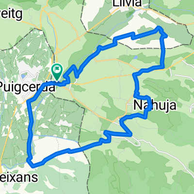
 Puigcerda-Masella-Molina-Palau-Puigcerda
- Distance
- 53.1 km
- Ascent
- 1,327 m
- Descent
- 1,323 m
- Location
- la Guingueta d'Ix, Occitanie, France
 Primera salida
- Distance
- 24.3 km
- Ascent
- 261 m
- Descent
- 261 m
- Location
- la Guingueta d'Ix, Occitanie, France
 Tarascon-sur-Ariège - Font-Romeu
- Distance
- 203.3 km
- Ascent
- 3,181 m
- Descent
- 4,569 m
- Location
- la Guingueta d'Ix, Occitanie, France
 puigcerdà-la seu-la noguera- aneu-aran-pirineu frança-puigcerdà
- Distance
- 448.7 km
- Ascent
- 6,371 m
- Descent
- 6,368 m
- Location
- la Guingueta d'Ix, Occitanie, France
Open it in the app