

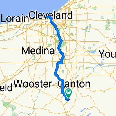
11091 Fort Laurens Rd NW, Bolivar to State Route 800 NE, Zoarville
A cycling route starting in Strasburg, Ohio, United States.
Overview
About this route
- 38 min
- Duration
- 9.1 km
- Distance
- 62 m
- Ascent
- 69 m
- Descent
- 14.2 km/h
- Avg. speed
- 291 m
- Max. altitude
Route quality
Waytypes & surfaces along the route
Waytypes
Cycleway
8.8 km
(97 %)
Quiet road
0.2 km
(2 %)
Surfaces
Paved
0.1 km
(1 %)
Unpaved
8.1 km
(89 %)
Unpaved (undefined)
8 km
(89 %)
Concrete
0.1 km
(<1 %)
Continue with Bikemap
Use, edit, or download this cycling route
You would like to ride 11091 Fort Laurens Rd NW, Bolivar to State Route 800 NE, Zoarville or customize it for your own trip? Here is what you can do with this Bikemap route:
Free features
- Save this route as favorite or in collections
- Copy & plan your own version of this route
- Sync your route with Garmin or Wahoo
Premium features
Free trial for 3 days, or one-time payment. More about Bikemap Premium.
- Navigate this route on iOS & Android
- Export a GPX / KML file of this route
- Create your custom printout (try it for free)
- Download this route for offline navigation
Discover more Premium features.
Get Bikemap PremiumFrom our community
Other popular routes starting in Strasburg
 101–199 Canal St NE, Bolivar to 6999 SR-212, Zoarville
- Distance
- 12.4 km
- Ascent
- 73 m
- Descent
- 78 m
- Location
- Strasburg, Ohio, United States
 Zoar Valley Trail to Breitenbach Winery
- Distance
- 26.1 km
- Ascent
- 213 m
- Descent
- 172 m
- Location
- Strasburg, Ohio, United States
 Ohio Gap3: Zoar to Conotton
- Distance
- 40.2 km
- Ascent
- 592 m
- Descent
- 581 m
- Location
- Strasburg, Ohio, United States
 Slow ride in Dover
- Distance
- 10 km
- Ascent
- 138 m
- Descent
- 138 m
- Location
- Strasburg, Ohio, United States
 SR-212, Bolivar to 9684 Mill Bridge Square NE, Bolivar
- Distance
- 4 km
- Ascent
- 16 m
- Descent
- 9 m
- Location
- Strasburg, Ohio, United States
 Canal St NE, Bolivar to Pine St NW, Bolivar
- Distance
- 275.5 km
- Ascent
- 1,270 m
- Descent
- 1,268 m
- Location
- Strasburg, Ohio, United States
 SR-212, Bolivar to SR-212, Bolivar
- Distance
- 11.2 km
- Ascent
- 19 m
- Descent
- 20 m
- Location
- Strasburg, Ohio, United States
 450 Canal St SE, Bolivar to 450 Canal St SE, Bolivar
- Distance
- 50.2 km
- Ascent
- 570 m
- Descent
- 572 m
- Location
- Strasburg, Ohio, United States
Open it in the app