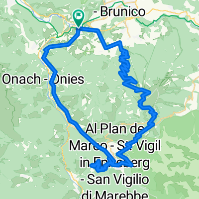
Alpencross 2011 - 3. Etappe
A cycling route starting in St. Lorenzen, Trentino-Alto Adige, Italy.
Overview
About this route
- -:--
- Duration
- 54.1 km
- Distance
- 1,997 m
- Ascent
- 828 m
- Descent
- ---
- Avg. speed
- ---
- Avg. speed
Continue with Bikemap
Use, edit, or download this cycling route
You would like to ride Alpencross 2011 - 3. Etappe or customize it for your own trip? Here is what you can do with this Bikemap route:
Free features
- Save this route as favorite or in collections
- Copy & plan your own version of this route
- Sync your route with Garmin or Wahoo
Premium features
Free trial for 3 days, or one-time payment. More about Bikemap Premium.
- Navigate this route on iOS & Android
- Export a GPX / KML file of this route
- Create your custom printout (try it for free)
- Download this route for offline navigation
Discover more Premium features.
Get Bikemap PremiumFrom our community
Other popular routes starting in St. Lorenzen
- Dolomiti 2013 - 2. den
- Distance
- 46.3 km
- Ascent
- 1,050 m
- Descent
- 1,056 m
- Location
- St. Lorenzen, Trentino-Alto Adige, Italy
- Da San Lorenzo di Sebato, Stazione di San Lorenzo a Via Chienes 4A
- Distance
- 8.1 km
- Ascent
- 93 m
- Descent
- 105 m
- Location
- St. Lorenzen, Trentino-Alto Adige, Italy
- Ebike Test: Centurion Backfire 2000
- Distance
- 7.7 km
- Ascent
- 493 m
- Descent
- 30 m
- Location
- St. Lorenzen, Trentino-Alto Adige, Italy
- Bruneck - Pertinger Alm
- Distance
- 44.2 km
- Ascent
- 1,259 m
- Descent
- 1,259 m
- Location
- St. Lorenzen, Trentino-Alto Adige, Italy
- eBiketest Centurion no pogo 2000+
- Distance
- 39.9 km
- Ascent
- 1,092 m
- Descent
- 1,091 m
- Location
- St. Lorenzen, Trentino-Alto Adige, Italy
- Kronplatz - Furkelpass
- Distance
- 57.2 km
- Ascent
- 1,569 m
- Descent
- 1,569 m
- Location
- St. Lorenzen, Trentino-Alto Adige, Italy
- Brunico - Anterselva - Passo Stalle
- Distance
- 37.6 km
- Ascent
- 1,266 m
- Descent
- 23 m
- Location
- St. Lorenzen, Trentino-Alto Adige, Italy
- mantana, Rio Pusteria, Alpe di Rodengo, Elle, Mantana
- Distance
- 51.1 km
- Ascent
- 1,414 m
- Descent
- 1,412 m
- Location
- St. Lorenzen, Trentino-Alto Adige, Italy
Open it in the app