
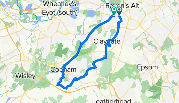
1A St Mary's Road, Surbiton to 50–54 Thorkhill Road, Long Ditton, Thames Ditton
A cycling route starting in Ditton Hill, England, United Kingdom.
Overview
About this route
- 1 h 16 min
- Duration
- 28 km
- Distance
- 279 m
- Ascent
- 284 m
- Descent
- 22.2 km/h
- Avg. speed
- 70 m
- Max. altitude

Route quality
Waytypes & surfaces along the route
Waytypes
Busy road
8.7 km
(31 %)
Road
7.5 km
(27 %)
Surfaces
Paved
16.6 km
(59 %)
Unpaved
2 km
(7 %)
Asphalt
16.3 km
(58 %)
Ground
1.2 km
(4 %)
Continue with Bikemap
Use, edit, or download this cycling route
You would like to ride 1A St Mary's Road, Surbiton to 50–54 Thorkhill Road, Long Ditton, Thames Ditton or customize it for your own trip? Here is what you can do with this Bikemap route:
Free features
- Save this route as favorite or in collections
- Copy & plan your own version of this route
- Sync your route with Garmin or Wahoo
Premium features
Free trial for 3 days, or one-time payment. More about Bikemap Premium.
- Navigate this route on iOS & Android
- Export a GPX / KML file of this route
- Create your custom printout (try it for free)
- Download this route for offline navigation
Discover more Premium features.
Get Bikemap PremiumFrom our community
Other popular routes starting in Ditton Hill
 Leith Hill
- Distance
- 31.1 km
- Ascent
- 465 m
- Descent
- 183 m
- Location
- Ditton Hill, England, United Kingdom
 Surbiton to Oxford v2
- Distance
- 136.6 km
- Ascent
- 683 m
- Descent
- 635 m
- Location
- Ditton Hill, England, United Kingdom
 Route 1
- Distance
- 5.5 km
- Ascent
- 31 m
- Descent
- 34 m
- Location
- Ditton Hill, England, United Kingdom
 Surbiton to 15 Hampton Court Palace
- Distance
- 4.6 km
- Ascent
- 17 m
- Descent
- 17 m
- Location
- Ditton Hill, England, United Kingdom
 135 Douglas Road, Surbiton to 194 Addiscombe Road, Croydon
- Distance
- 20.7 km
- Ascent
- 70 m
- Descent
- 30 m
- Location
- Ditton Hill, England, United Kingdom
 Surrey Route
- Distance
- 52.2 km
- Ascent
- 330 m
- Descent
- 332 m
- Location
- Ditton Hill, England, United Kingdom
 Surbiton hockey club home
- Distance
- 68.4 km
- Ascent
- 392 m
- Descent
- 352 m
- Location
- Ditton Hill, England, United Kingdom
 1A St Mary's Road, Surbiton to 50–54 Thorkhill Road, Long Ditton, Thames Ditton
- Distance
- 28 km
- Ascent
- 279 m
- Descent
- 284 m
- Location
- Ditton Hill, England, United Kingdom
Open it in the app