

Travemünde Schotterschleichstrecke
A cycling route starting in Lübeck, Schleswig-Holstein, Germany.
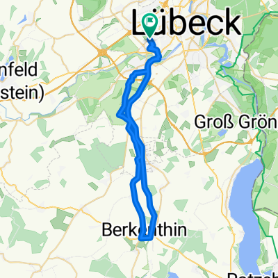
Overview
About this route
Bisschen abenteuerlich und mit 33 km viel zu langer Weg nach Travemünde, aber war trotzdem interessant. :-)
- 75 h 59 min
- Duration
- 33.1 km
- Distance
- 174 m
- Ascent
- 180 m
- Descent
- 0.4 km/h
- Avg. speed
- 55 m
- Max. altitude

Route photos


Continue with Bikemap
Use, edit, or download this cycling route
You would like to ride Travemünde Schotterschleichstrecke or customize it for your own trip? Here is what you can do with this Bikemap route:
Free features
- Save this route as favorite or in collections
- Copy & plan your own version of this route
- Sync your route with Garmin or Wahoo
Premium features
Free trial for 3 days, or one-time payment. More about Bikemap Premium.
- Navigate this route on iOS & Android
- Export a GPX / KML file of this route
- Create your custom printout (try it for free)
- Download this route for offline navigation
Discover more Premium features.
Get Bikemap PremiumFrom our community
Other popular routes starting in Lübeck
 Feiertagsrunde mit Bennet
- Distance
- 35.5 km
- Ascent
- 87 m
- Descent
- 87 m
- Location
- Lübeck, Schleswig-Holstein, Germany
 Die Steilküste entlang nach Boltenhagen
- Distance
- 100.7 km
- Ascent
- 297 m
- Descent
- 294 m
- Location
- Lübeck, Schleswig-Holstein, Germany
 Kleine Sonnenuntergangsrunde
- Distance
- 38.8 km
- Ascent
- 76 m
- Descent
- 78 m
- Location
- Lübeck, Schleswig-Holstein, Germany
 Schaalseerunde
- Distance
- 120.1 km
- Ascent
- 424 m
- Descent
- 425 m
- Location
- Lübeck, Schleswig-Holstein, Germany
 St. Lorenz Nord nach Travemünde by Sven und Cata
- Distance
- 44.8 km
- Ascent
- 272 m
- Descent
- 268 m
- Location
- Lübeck, Schleswig-Holstein, Germany
 Elbe-Lübeck-Kanal 1
- Distance
- 17.6 km
- Ascent
- 56 m
- Descent
- 56 m
- Location
- Lübeck, Schleswig-Holstein, Germany
 Dag 1 söndag 1.7.18
- Distance
- 159.2 km
- Ascent
- 326 m
- Descent
- 282 m
- Location
- Lübeck, Schleswig-Holstein, Germany
 Disnack-Nusse-Steinhorst
- Distance
- 75.4 km
- Ascent
- 260 m
- Descent
- 262 m
- Location
- Lübeck, Schleswig-Holstein, Germany
Open it in the app