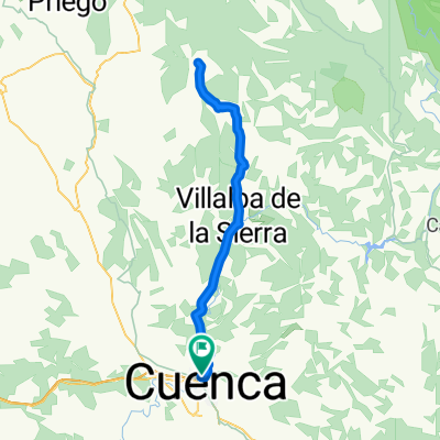
Cuenca - Cuevas Velasco - Valdecolmenas - Villarejo PeƱuela - Cuenca
A cycling route starting in Cuenca, Castille-La Mancha, Spain.
Overview
About this route
Route Cuenca - Cuevas Velasco - Valdecolmenas - Villarejo PeƱuela - Cuenca of about 80 km with lunch in Valdecolmenas. It can be extended by climbing up to Palomera.
- -:--
- Duration
- 80.7 km
- Distance
- 879 m
- Ascent
- 790 m
- Descent
- ---
- Avg. speed
- 1,154 m
- Max. altitude
Route quality
Waytypes & surfaces along the route
Waytypes
- Road - 31.5 km - (39 %) 
- Cycleway - 18.6 km - (23 %) 
Surfaces
Paved
8.1 km
(10 %)
Unpaved
8.1 km
(10 %)
- Asphalt - 7.3 km - (9 %) 
- Ground - 6.5 km - (8 %) 
Continue with Bikemap
Use, edit, or download this cycling route
You would like to ride Cuenca - Cuevas Velasco - Valdecolmenas - Villarejo PeƱuela - Cuenca or customize it for your own trip? Here is what you can do with this Bikemap route:
Free features
- Save this route as favorite or in collections
- Copy & plan your own version of this route
- Split it into stages to create a multi-day tour
- Sync your route with Garmin or Wahoo
Premium features
Free trial for 3 days, or one-time payment. More about Bikemap Premium.
- Navigate this route on iOS & Android
- Export a GPX / KML file of this route
- Create your custom printout (try it for free)
- Download this route for offline navigation
Discover more Premium features.
Get Bikemap PremiumFrom our community
Other popular routes starting in Cuenca
 Cuenca-ciudad encantada- Cuenca-ciudad encantada-- Distance
- 63.7 km
- Ascent
- 995 m
- Descent
- 989 m
- Location
- Cuenca, Castille-La Mancha, Spain
 
 Carrera Montana de Jabaga en Bici Carrera Montana de Jabaga en Bici- Distance
- 51.9 km
- Ascent
- 811 m
- Descent
- 811 m
- Location
- Cuenca, Castille-La Mancha, Spain
 
 Piedra del Yunque Piedra del Yunque- Distance
- 57.9 km
- Ascent
- 676 m
- Descent
- 668 m
- Location
- Cuenca, Castille-La Mancha, Spain
 
 Alto de la Nava Alto de la Nava- Distance
- 46.3 km
- Ascent
- 625 m
- Descent
- 624 m
- Location
- Cuenca, Castille-La Mancha, Spain
 
 Mini Ciudad Encantada Mini Ciudad Encantada- Distance
- 45.1 km
- Ascent
- 814 m
- Descent
- 815 m
- Location
- Cuenca, Castille-La Mancha, Spain
 
 Ruta de los Belenes de la senda de la Rambla Ruta de los Belenes de la senda de la Rambla- Distance
- 49 km
- Ascent
- 754 m
- Descent
- 754 m
- Location
- Cuenca, Castille-La Mancha, Spain
 
 Hora y Media Hora y Media- Distance
- 23.6 km
- Ascent
- 437 m
- Descent
- 435 m
- Location
- Cuenca, Castille-La Mancha, Spain
 
 Antenas + Antenas +- Distance
- 22.4 km
- Ascent
- 519 m
- Descent
- 525 m
- Location
- Cuenca, Castille-La Mancha, Spain
 
Open it in the app


