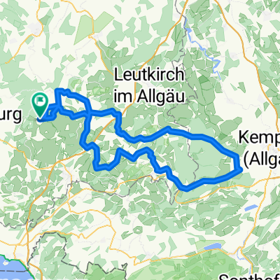
Grüner Baum-St, Gallen
A cycling route starting in Vogt, Baden-Wurttemberg, Germany.
Overview
About this route
- -:--
- Duration
- 79.5 km
- Distance
- 830 m
- Ascent
- 771 m
- Descent
- ---
- Avg. speed
- 707 m
- Max. altitude
Route quality
Waytypes & surfaces along the route
Waytypes
Quiet road
41.6 km
(52 %)
Road
9.8 km
(12 %)
Surfaces
Paved
70.7 km
(89 %)
Unpaved
2.2 km
(3 %)
Asphalt
66.8 km
(84 %)
Paved (undefined)
3.1 km
(4 %)
Continue with Bikemap
Use, edit, or download this cycling route
You would like to ride Grüner Baum-St, Gallen or customize it for your own trip? Here is what you can do with this Bikemap route:
Free features
- Save this route as favorite or in collections
- Copy & plan your own version of this route
- Sync your route with Garmin or Wahoo
Premium features
Free trial for 3 days, or one-time payment. More about Bikemap Premium.
- Navigate this route on iOS & Android
- Export a GPX / KML file of this route
- Create your custom printout (try it for free)
- Download this route for offline navigation
Discover more Premium features.
Get Bikemap PremiumFrom our community
Other popular routes starting in Vogt
- Allgäutour
- Distance
- 113.9 km
- Ascent
- 625 m
- Descent
- 625 m
- Location
- Vogt, Baden-Wurttemberg, Germany
- Rund um Vogt
- Distance
- 551.1 km
- Ascent
- 2,038 m
- Descent
- 2,017 m
- Location
- Vogt, Baden-Wurttemberg, Germany
- 24.08.2020 33 Seen-Weiher-Tour
- Distance
- 98 km
- Ascent
- 1,367 m
- Descent
- 1,367 m
- Location
- Vogt, Baden-Wurttemberg, Germany
- Pfänderrunde von Vogt
- Distance
- 103.9 km
- Ascent
- 929 m
- Descent
- 929 m
- Location
- Vogt, Baden-Wurttemberg, Germany
- Grüner Baum-St, Gallen
- Distance
- 79.5 km
- Ascent
- 830 m
- Descent
- 771 m
- Location
- Vogt, Baden-Wurttemberg, Germany
- Gute Radler - Tour Vogt
- Distance
- 122.1 km
- Ascent
- 348 m
- Descent
- 599 m
- Location
- Vogt, Baden-Wurttemberg, Germany
- Vogt - Legau - Vogt
- Distance
- 88 km
- Ascent
- 440 m
- Descent
- 439 m
- Location
- Vogt, Baden-Wurttemberg, Germany
- Durch das württembergische Allgäü
- Distance
- 66.1 km
- Ascent
- 420 m
- Descent
- 421 m
- Location
- Vogt, Baden-Wurttemberg, Germany
Open it in the app