
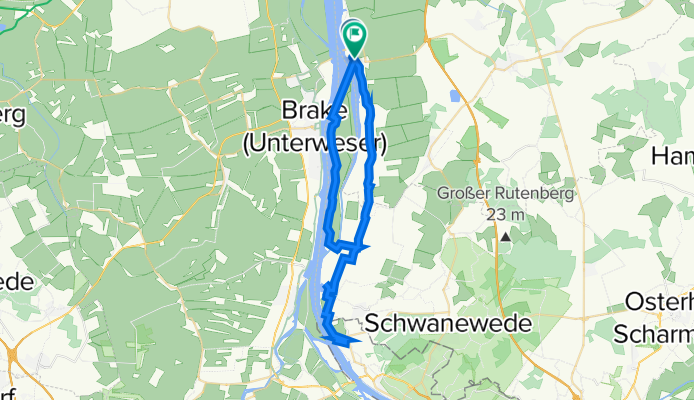
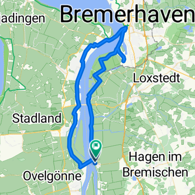
and +U-Bootbunker Valentin
A cycling route starting in Sandstedt, Lower Saxony, Germany.
Overview
About this route
- 4 h 51 min
- Duration
- 46.6 km
- Distance
- 267 m
- Ascent
- 268 m
- Descent
- 9.6 km/h
- Avg. speed
- 48 m
- Max. altitude

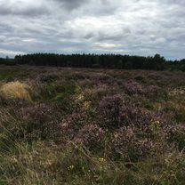
Route photos

Continue with Bikemap
Use, edit, or download this cycling route
You would like to ride and +U-Bootbunker Valentin or customize it for your own trip? Here is what you can do with this Bikemap route:
Free features
- Save this route as favorite or in collections
- Copy & plan your own version of this route
- Sync your route with Garmin or Wahoo
Premium features
Free trial for 3 days, or one-time payment. More about Bikemap Premium.
- Navigate this route on iOS & Android
- Export a GPX / KML file of this route
- Create your custom printout (try it for free)
- Download this route for offline navigation
Discover more Premium features.
Get Bikemap PremiumFrom our community
Other popular routes starting in Sandstedt
 Landschlachterei Werner Schöwe -> nach Norderdeichstrasse 2, 27612 Loxstedt OT Eidewarden
- Distance
- 22.2 km
- Ascent
- 0 m
- Descent
- 0 m
- Location
- Sandstedt, Lower Saxony, Germany
 and +U-Bootbunker Valentin
- Distance
- 46.6 km
- Ascent
- 267 m
- Descent
- 268 m
- Location
- Sandstedt, Lower Saxony, Germany
 27.8. zweite etappe sandstedt bornhöved
- Distance
- 179.5 km
- Ascent
- 279 m
- Descent
- 239 m
- Location
- Sandstedt, Lower Saxony, Germany
 Sandstedt Ostufer nach Dillener Straße 59B, Bremen
- Distance
- 24 km
- Ascent
- 87 m
- Descent
- 69 m
- Location
- Sandstedt, Lower Saxony, Germany
 Sandstedt-Bhv
- Distance
- 22.2 km
- Ascent
- 4 m
- Descent
- 0 m
- Location
- Sandstedt, Lower Saxony, Germany
 Route in Hagen im Bremischen
- Distance
- 57.9 km
- Ascent
- 24 m
- Descent
- 25 m
- Location
- Sandstedt, Lower Saxony, Germany
 Rundfahrt Harriersand
- Distance
- 28.6 km
- Ascent
- 14 m
- Descent
- 15 m
- Location
- Sandstedt, Lower Saxony, Germany
 Recovered Route
- Distance
- 84 km
- Ascent
- 289 m
- Descent
- 279 m
- Location
- Sandstedt, Lower Saxony, Germany
Open it in the app