

Deichtour
A cycling route starting in Hinte, Lower Saxony, Germany.
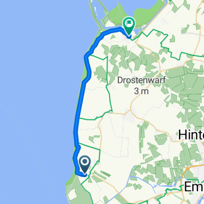
Overview
About this route
We start in Groothusen. Founded in the 8th century, Groothusen is one of the oldest villages in Krummhörn. Groothusen was located at the bay of Sielmönken and was navigable. Unlike other Warfen villages that are rounded, Groothusen has an elongated shape, the harbor was on the north side of the place.
In the 14th century, there were three castles in Groothusen: the Westerburg, the Osterburg, and the Middelsteburg. The St. Peter's Church, a brick and tuff stone building built around 1400. Through the Tiede-Ubben Straße, we continue along the county road to Hamswehrum. This farming village is first mentioned around 1375. There used to be a castle and a Gothic church here. However, neither building exists anymore. In place of the old church, a new one was built in 1968. On the cycle path located along the county road, we continue towards Upleward. Upleward also once had a castle, the Gothic church dates back to the 14th century. Via Erbsenbindereistraße, we reach the sea dyke and campsite. Here, there is a dyke bathing beach with the possibility of mudflat hiking and a unique rarity: a sandy beach behind the dyke (campsite/restaurant). To our left is the Campener Lighthouse (with observation platform). However, we turn right towards Greetsiel until we reach Leehaus (small parking lot). Here we follow the Frisian route 'Rad up Pad' until about 9.7 km, where we turn left again towards Manslagt, via the 'Altendeichweg'. On the left side, there is a large wind farm. Passing the farm 'Gr. Hoorenburg' we arrive in Manslagt via the 'Plaathauserweg'. At the time of its creation, the Warfen settlement was an island in the Wadden Sea. The Manslagt church dates from the 14th century, the pulpit from 1714, sarcophagi from the 12th century (restaurants). Along the county road on the cycle path (a former narrow-gauge railway) we return to the starting point, Groothusen.
- -:--
- Duration
- 14 km
- Distance
- 0 m
- Ascent
- 0 m
- Descent
- ---
- Avg. speed
- 1 m
- Max. altitude
Route quality
Waytypes & surfaces along the route
Waytypes
Quiet road
6.3 km
(45 %)
Track
3.1 km
(22 %)
Surfaces
Paved
8.2 km
(59 %)
Asphalt
8.2 km
(59 %)
Undefined
5.7 km
(41 %)
Continue with Bikemap
Use, edit, or download this cycling route
You would like to ride Deichtour or customize it for your own trip? Here is what you can do with this Bikemap route:
Free features
- Save this route as favorite or in collections
- Copy & plan your own version of this route
- Sync your route with Garmin or Wahoo
Premium features
Free trial for 3 days, or one-time payment. More about Bikemap Premium.
- Navigate this route on iOS & Android
- Export a GPX / KML file of this route
- Create your custom printout (try it for free)
- Download this route for offline navigation
Discover more Premium features.
Get Bikemap PremiumFrom our community
Other popular routes starting in Hinte
 Drei Meere Weg
- Distance
- 44.3 km
- Ascent
- 0 m
- Descent
- 0 m
- Location
- Hinte, Lower Saxony, Germany
 Buchfinkenstraße nach Sielstraße
- Distance
- 19 km
- Ascent
- 10 m
- Descent
- 8 m
- Location
- Hinte, Lower Saxony, Germany
 Gersteweg 5, Hinte nach Gersteweg 2, Hinte
- Distance
- 59.9 km
- Ascent
- 1,231 m
- Descent
- 1,231 m
- Location
- Hinte, Lower Saxony, Germany
 Von Rysum nach Greetsiel
- Distance
- 25.4 km
- Ascent
- 10 m
- Descent
- 13 m
- Location
- Hinte, Lower Saxony, Germany
 Pilsumer Leuchtturm und Emden
- Distance
- 54.6 km
- Ascent
- 21 m
- Descent
- 21 m
- Location
- Hinte, Lower Saxony, Germany
 Tour Nr. 8
- Distance
- 29.3 km
- Ascent
- 0 m
- Descent
- 3 m
- Location
- Hinte, Lower Saxony, Germany
 Nostseeroute
- Distance
- 129.2 km
- Ascent
- 22 m
- Descent
- 25 m
- Location
- Hinte, Lower Saxony, Germany
 Gemütliche Route in Krummhörn
- Distance
- 39.8 km
- Ascent
- 46 m
- Descent
- 44 m
- Location
- Hinte, Lower Saxony, Germany
Open it in the app