

Prenden Tour
A cycling route starting in Alt-Hohenschönhausen, State of Berlin, Germany.
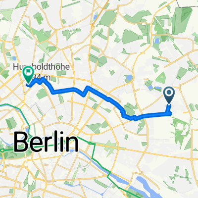
Overview
About this route
Partial exclusion zone
- -:--
- Duration
- 90.4 km
- Distance
- 146 m
- Ascent
- 148 m
- Descent
- ---
- Avg. speed
- ---
- Max. altitude
Route quality
Waytypes & surfaces along the route
Waytypes
Quiet road
27.1 km
(30 %)
Track
11.8 km
(13 %)
Surfaces
Paved
66 km
(73 %)
Unpaved
9.9 km
(11 %)
Asphalt
57 km
(63 %)
Concrete
5.4 km
(6 %)
Route highlights
Points of interest along the route

Photo after 45.3 km

Photo after 55.3 km

Photo after 55.3 km

Photo after 55.3 km

Photo after 55.8 km

Photo after 56.2 km

Photo after 57.5 km
Objekt 17/5001

Photo after 57.6 km
Objekt 17/5001

Photo after 57.7 km
Objekt 17/5001

Photo after 58.1 km
Objekt 17/5001

Photo after 58.2 km
Objekt 17/5001

Photo after 58.2 km
Objekt 17/5001

Photo after 58.2 km
Objekt 17/5001

Photo after 58.3 km
Objekt 17/5001

Photo after 58.3 km
Objekt 17/5001

Point of interest after 58.3 km
Objekt 17/5001

Photo after 58.3 km
Objekt 17/5001
Continue with Bikemap
Use, edit, or download this cycling route
You would like to ride Prenden Tour or customize it for your own trip? Here is what you can do with this Bikemap route:
Free features
- Save this route as favorite or in collections
- Copy & plan your own version of this route
- Split it into stages to create a multi-day tour
- Sync your route with Garmin or Wahoo
Premium features
Free trial for 3 days, or one-time payment. More about Bikemap Premium.
- Navigate this route on iOS & Android
- Export a GPX / KML file of this route
- Create your custom printout (try it for free)
- Download this route for offline navigation
Discover more Premium features.
Get Bikemap PremiumFrom our community
Other popular routes starting in Alt-Hohenschönhausen
 Sundowner
- Distance
- 36.2 km
- Ascent
- 140 m
- Descent
- 138 m
- Location
- Alt-Hohenschönhausen, State of Berlin, Germany
 Berlin City Tour
- Distance
- 41.9 km
- Ascent
- 114 m
- Descent
- 113 m
- Location
- Alt-Hohenschönhausen, State of Berlin, Germany
 Gosener Berge Tour
- Distance
- 59.9 km
- Ascent
- 97 m
- Descent
- 95 m
- Location
- Alt-Hohenschönhausen, State of Berlin, Germany
 Route in Berlin
- Distance
- 11.9 km
- Ascent
- 37 m
- Descent
- 52 m
- Location
- Alt-Hohenschönhausen, State of Berlin, Germany
 Berlin City Tour 2
- Distance
- 45.6 km
- Ascent
- 66 m
- Descent
- 64 m
- Location
- Alt-Hohenschönhausen, State of Berlin, Germany
 120623 Eberswalde und zurück in 3 Stunden
- Distance
- 99.6 km
- Ascent
- 181 m
- Descent
- 179 m
- Location
- Alt-Hohenschönhausen, State of Berlin, Germany
 Berlin - Meißen
- Distance
- 189.8 km
- Ascent
- 322 m
- Descent
- 271 m
- Location
- Alt-Hohenschönhausen, State of Berlin, Germany
 Kurze schnelle über Mehrow, ALB
- Distance
- 40.3 km
- Ascent
- 69 m
- Descent
- 72 m
- Location
- Alt-Hohenschönhausen, State of Berlin, Germany
Open it in the app