
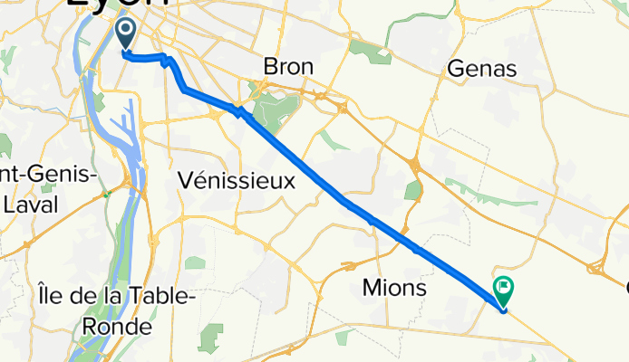
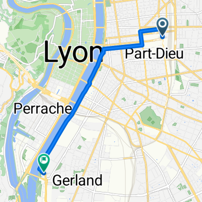
32 Rue Crepet, Lyon à 1 Chemin de la Madone, Saint-Pierre-de-Chandieu
A cycling route starting in Lyon, Auvergne-Rhône-Alpes, France.
Overview
About this route
- 1 h 18 min
- Duration
- 17.2 km
- Distance
- 88 m
- Ascent
- 13 m
- Descent
- 13.3 km/h
- Avg. speed
- 244 m
- Max. altitude

Route quality
Waytypes & surfaces along the route
Waytypes
Road
3.8 km
(22 %)
Quiet road
2.6 km
(15 %)
Surfaces
Paved
14.3 km
(83 %)
Asphalt
14.1 km
(82 %)
Concrete
0.2 km
(1 %)
Undefined
2.9 km
(17 %)
Continue with Bikemap
Use, edit, or download this cycling route
You would like to ride 32 Rue Crepet, Lyon à 1 Chemin de la Madone, Saint-Pierre-de-Chandieu or customize it for your own trip? Here is what you can do with this Bikemap route:
Free features
- Save this route as favorite or in collections
- Copy & plan your own version of this route
- Sync your route with Garmin or Wahoo
Premium features
Free trial for 3 days, or one-time payment. More about Bikemap Premium.
- Navigate this route on iOS & Android
- Export a GPX / KML file of this route
- Create your custom printout (try it for free)
- Download this route for offline navigation
Discover more Premium features.
Get Bikemap PremiumFrom our community
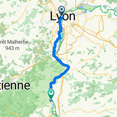
Other popular routes starting in Lyon
 Lyon - Saint-Clair-du-Rhône
- Distance
- 55.9 km
- Ascent
- 445 m
- Descent
- 483 m
- Location
- Lyon, Auvergne-Rhône-Alpes, France
 Lyon - Andancette
- Distance
- 61.6 km
- Ascent
- 457 m
- Descent
- 563 m
- Location
- Lyon, Auvergne-Rhône-Alpes, France
 Place Antonin Poncet, Lyon to Place de Fourvière, Lyon
- Distance
- 4.2 km
- Ascent
- 139 m
- Descent
- 17 m
- Location
- Lyon, Auvergne-Rhône-Alpes, France
 Route nach Gare Perpignan
- Distance
- 610.3 km
- Ascent
- 1,819 m
- Descent
- 1,964 m
- Location
- Lyon, Auvergne-Rhône-Alpes, France
 Quai Victor Augagneur, Lyon to Rue Maryse Bastié, Bron
- Distance
- 17.7 km
- Ascent
- 72 m
- Descent
- 32 m
- Location
- Lyon, Auvergne-Rhône-Alpes, France
 1. Lyon Bahnhof - Ibis Lyon Gerland Musèe
- Distance
- 5.5 km
- Ascent
- 21 m
- Descent
- 28 m
- Location
- Lyon, Auvergne-Rhône-Alpes, France
 2013.03.12 Ouest lyonnais
- Distance
- 47.1 km
- Ascent
- 425 m
- Descent
- 428 m
- Location
- Lyon, Auvergne-Rhône-Alpes, France
 Lyon-Vernaison
- Distance
- 37.3 km
- Ascent
- 242 m
- Descent
- 242 m
- Location
- Lyon, Auvergne-Rhône-Alpes, France
Open it in the app