

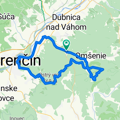
17. novembra 37 do 17. novembra 290
A cycling route starting in Trenčianske Teplice, Nitra Region, Slovakia.
Overview
About this route
- 3 h 43 min
- Duration
- 35.1 km
- Distance
- 372 m
- Ascent
- 441 m
- Descent
- 9.5 km/h
- Avg. speed
- 354 m
- Max. altitude

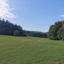
Route photos


Route quality
Waytypes & surfaces along the route
Waytypes
Quiet road
10.2 km
(29 %)
Access road
5.6 km
(16 %)
Surfaces
Paved
23.5 km
(67 %)
Unpaved
2.5 km
(7 %)
Asphalt
23.5 km
(67 %)
Ground
1.8 km
(5 %)
Continue with Bikemap
Use, edit, or download this cycling route
You would like to ride 17. novembra 37 do 17. novembra 290 or customize it for your own trip? Here is what you can do with this Bikemap route:
Free features
- Save this route as favorite or in collections
- Copy & plan your own version of this route
- Sync your route with Garmin or Wahoo
Premium features
Free trial for 3 days, or one-time payment. More about Bikemap Premium.
- Navigate this route on iOS & Android
- Export a GPX / KML file of this route
- Create your custom printout (try it for free)
- Download this route for offline navigation
Discover more Premium features.
Get Bikemap PremiumFrom our community
Other popular routes starting in Trenčianske Teplice
 17. novembra 37 do 17. novembra 290
- Distance
- 35.1 km
- Ascent
- 372 m
- Descent
- 441 m
- Location
- Trenčianske Teplice, Nitra Region, Slovakia
 Tren. Teplice-TN-Lucky-Machnac-Baske-Tren. Teplice
- Distance
- 52.3 km
- Ascent
- 1,080 m
- Descent
- 1,080 m
- Location
- Trenčianske Teplice, Nitra Region, Slovakia
 Trenčianske Teplice - Motešice - Bobot
- Distance
- 13 km
- Ascent
- 203 m
- Descent
- 239 m
- Location
- Trenčianske Teplice, Nitra Region, Slovakia
 klepáč - baračka
- Distance
- 14.4 km
- Ascent
- 443 m
- Descent
- 444 m
- Location
- Trenčianske Teplice, Nitra Region, Slovakia
 Trasa do Na Zongorke 7290/10, Trenčín
- Distance
- 80.8 km
- Ascent
- 524 m
- Descent
- 939 m
- Location
- Trenčianske Teplice, Nitra Region, Slovakia
 Trenčianske Teplice Radfahren
- Distance
- 42.1 km
- Ascent
- 560 m
- Descent
- 558 m
- Location
- Trenčianske Teplice, Nitra Region, Slovakia
 Soblahovská chata-Trenčín
- Distance
- 12.6 km
- Ascent
- 131 m
- Descent
- 475 m
- Location
- Trenčianske Teplice, Nitra Region, Slovakia
 Homôlka-Zliechov-Mojtín-Košecké Podhradie-Iliavka-Dubnica.
- Distance
- 51.6 km
- Ascent
- 1,770 m
- Descent
- 2,164 m
- Location
- Trenčianske Teplice, Nitra Region, Slovakia
Open it in the app