Kolesarjenje ob Savi 23
A cycling route starting in RadeÄe, RadeÄe Municipality, Slovenia.
Overview
About this route
Route
- -:--
- Duration
- 47.1 km
- Distance
- 257 m
- Ascent
- 290 m
- Descent
- ---
- Avg. speed
- 213 m
- Max. altitude
Route highlights
Points of interest along the route
Point of interest after 4.2 km
REDITELJ
Point of interest after 4.4 km
REDITELJ
Point of interest after 5.9 km
REDITEJ
Point of interest after 6 km
REDITELJ
Point of interest after 7.3 km
REDITELJ
Point of interest after 7.5 km
REDITELJ
Point of interest after 7.5 km
REDITELJ
Point of interest after 7.7 km
REDITELJ
Point of interest after 8.6 km
REDITELJ
Point of interest after 9.3 km
REDITELJ
Point of interest after 10 km
Point of interest after 11.9 km
REDITELJ
Point of interest after 13.5 km
REDITELJ
Point of interest after 13.7 km
REDITELJ
Point of interest after 15.9 km
REDITELJ
Point of interest after 16.1 km
REDITELJ
Point of interest after 16.3 km
REDITELJ
Point of interest after 22.5 km
REDAR
Point of interest after 22.6 km
REDAR
Point of interest after 23 km
REDAR
Point of interest after 34 km
RADARJI
Point of interest after 35.8 km
REDARJI
Point of interest after 45.8 km
REDARJI
Point of interest after 46.4 km
REDARJI
Continue with Bikemap
Use, edit, or download this cycling route
You would like to ride Kolesarjenje ob Savi 23 or customize it for your own trip? Here is what you can do with this Bikemap route:
Free features
- Save this route as favorite or in collections
- Copy & plan your own version of this route
- Sync your route with Garmin or Wahoo
Premium features
Free trial for 3 days, or one-time payment. More about Bikemap Premium.
- Navigate this route on iOS & Android
- Export a GPX / KML file of this route
- Create your custom printout (try it for free)
- Download this route for offline navigation
Discover more Premium features.
Get Bikemap PremiumFrom our community
Other popular routes starting in RadeÄe
- Kolesarjenje ob Savi 23
- Distance
- 47.1 km
- Ascent
- 257 m
- Descent
- 290 m
- Location
- RadeÄe, RadeÄe Municipality, Slovenia
- Jagnjenica-Podkum-PolÅ”nik-Pasjek-Mamolj-Velika Preska-Äeplje-Dole-Sopota
- Distance
- 65.1 km
- Ascent
- 2,018 m
- Descent
- 2,021 m
- Location
- RadeÄe, RadeÄe Municipality, Slovenia
- lisca
- Distance
- 9.9 km
- Ascent
- 792 m
- Descent
- 58 m
- Location
- RadeÄe, RadeÄe Municipality, Slovenia
- PANTARCA 3A
- Distance
- 45.2 km
- Ascent
- 237 m
- Descent
- 564 m
- Location
- RadeÄe, RadeÄe Municipality, Slovenia
- podkraj-kum
- Distance
- 12.5 km
- Ascent
- 1,167 m
- Descent
- 257 m
- Location
- RadeÄe, RadeÄe Municipality, Slovenia
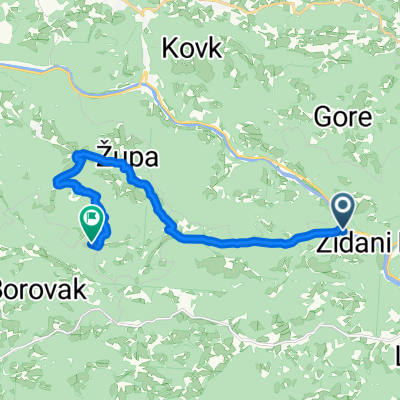
- Zidani Most-Logarska Dolina
- Distance
- 97.2 km
- Ascent
- 982 m
- Descent
- 175 m
- Location
- RadeÄe, RadeÄe Municipality, Slovenia
- Dravinja 21. 3. dan RadeÄe = Å martno pri Litiji
- Distance
- 39.7 km
- Ascent
- 363 m
- Descent
- 768 m
- Location
- RadeÄe, RadeÄe Municipality, Slovenia
- Route to Mirna gora
- Distance
- 77.9 km
- Ascent
- 2,358 m
- Descent
- 1,524 m
- Location
- RadeÄe, RadeÄe Municipality, Slovenia
Open it in the app