

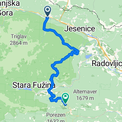
Mojstrana - Rifugio Zacchi - in nazaj
A cycling route starting in Hrušica, Jesenice, Slovenia.
Overview
About this route
štart mojstrana - cilj rifugio zacchi - in nazaj
- -:--
- Duration
- 65.4 km
- Distance
- 1,066 m
- Ascent
- 1,063 m
- Descent
- ---
- Avg. speed
- 1,388 m
- Max. altitude

Route quality
Waytypes & surfaces along the route
Waytypes
Cycleway
30.9 km
(47 %)
Quiet road
13.5 km
(21 %)
Surfaces
Paved
53.7 km
(82 %)
Unpaved
9.3 km
(14 %)
Paved (undefined)
28.4 km
(43 %)
Asphalt
24.6 km
(38 %)
Continue with Bikemap
Use, edit, or download this cycling route
You would like to ride Mojstrana - Rifugio Zacchi - in nazaj or customize it for your own trip? Here is what you can do with this Bikemap route:
Free features
- Save this route as favorite or in collections
- Copy & plan your own version of this route
- Sync your route with Garmin or Wahoo
Premium features
Free trial for 3 days, or one-time payment. More about Bikemap Premium.
- Navigate this route on iOS & Android
- Export a GPX / KML file of this route
- Create your custom printout (try it for free)
- Download this route for offline navigation
Discover more Premium features.
Get Bikemap PremiumFrom our community
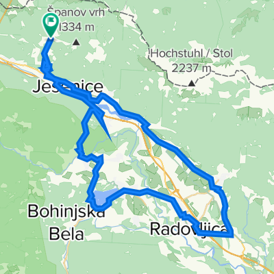
Other popular routes starting in Hrušica
 Mojstrana-italia-Vrsic-moistrana
- Distance
- 57.1 km
- Ascent
- 581 m
- Descent
- 582 m
- Location
- Hrušica, Jesenice, Slovenia
 Mojstrana - Bohinjska Bistrica
- Distance
- 53.7 km
- Ascent
- 2,507 m
- Descent
- 1,864 m
- Location
- Hrušica, Jesenice, Slovenia
 Bledi tókerülés (hard core)
- Distance
- 56 km
- Ascent
- 979 m
- Descent
- 978 m
- Location
- Hrušica, Jesenice, Slovenia
 Golica - kružna staza
- Distance
- 9.5 km
- Ascent
- 845 m
- Descent
- 852 m
- Location
- Hrušica, Jesenice, Slovenia
 Mojstrana - Krnica - Kovinarska koča
- Distance
- 46.3 km
- Ascent
- 528 m
- Descent
- 528 m
- Location
- Hrušica, Jesenice, Slovenia
 Mojstrana - Dolina reke Radovne - Bled - Koroška Bela - Jesenice - Mojstrana
- Distance
- 49 km
- Ascent
- 510 m
- Descent
- 510 m
- Location
- Hrušica, Jesenice, Slovenia
 Mojstrana - Rifugio Zacchi - in nazaj
- Distance
- 65.4 km
- Ascent
- 1,066 m
- Descent
- 1,063 m
- Location
- Hrušica, Jesenice, Slovenia
 Mojstrana-Bled
- Distance
- 45.7 km
- Ascent
- 536 m
- Descent
- 539 m
- Location
- Hrušica, Jesenice, Slovenia
Open it in the app